Discover Parks & Wildlife contains affiliate links and is a member of the Amazon Services LLC Associates Program. If you make a purchase using one of the Amazon links, we may receive compensation at no extra cost to you. We may also use select AI tools to support our creative process, but all content is reviewed, refined, and finalized by our human team. See our disclosure policy and our AI use policy for more information.
11 Off-The-Map Forest Roads With Hidden Trailheads Locals Quietly Keep To Themselves
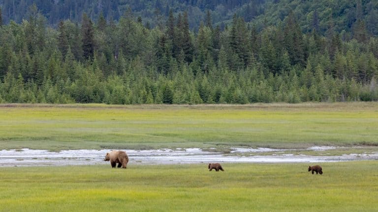
Tucked deep in the folds of America’s national forests, there are roads that rarely appear on casual itineraries. These aren’t scenic highways marked with overlooks or the paved drives promoted in brochures. They’re narrow, often gravel routes that twist through wild country and lead to hidden trailheads, forgotten ruins, and quiet waterfalls.
Local hikers know them well but seldom talk about them, partly to protect their solitude and partly because they’re not always simple to reach. But for those willing to venture beyond the main loops, these backroads reward patience with stillness, cooler air, and the unfiltered presence of the land itself.
From Georgia’s Appalachian foothills to Wyoming’s high ridges, each forest road listed here offers its own kind of discovery. Some end at major hiking routes, others stop beside tucked-away picnic spots or overlooks with no signs at all. The surfaces vary from graded dirt to gravel or pavement, yet nearly all remain passable for careful drivers in standard passenger cars during dry conditions.
Before setting out, always confirm seasonal closures and carry extra water, since services are often miles away.
Chattahoochee-Oconee National Forest, Georgia — USFS 42 To Springer Mountain Trailheads
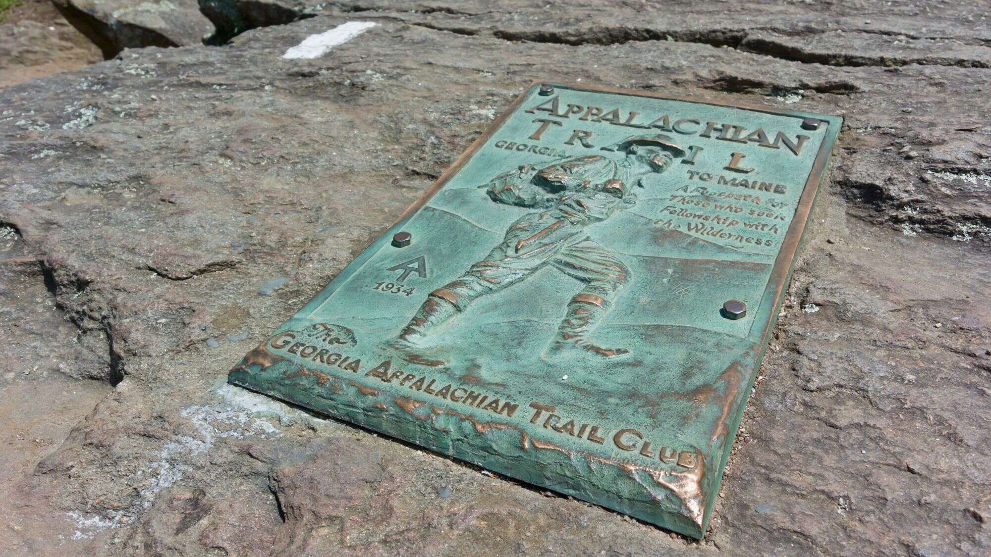
Deep in northern Georgia, USFS 42 winds over forested ridges toward the southern terminus of the Appalachian Trail at Springer Mountain. The road is gravel but generally well-maintained, open year-round without a routine winter gate. Weather, especially heavy rain or ice, can temporarily close sections though, so checking conditions before leaving paved roads is essential.
Passenger cars can handle it with care. But be cautious of loose rock on steeper grades. Along the way, you’ll pass stands of oak and hickory, a few dispersed campsites, and trailheads serving the Benton MacKaye and Appalachian Trails.
The Springer Mountain Trailhead itself sits near mile 6 of the road, marked by a small parking lot and kiosk. From here, a short uphill hike leads to the bronze plaque signifying the start of the Appalachian Trail. On clear days, the views across the Blue Ridge foothills make the dusty drive worthwhile. It’s a spot that feels both monumental and quiet, where long-distance hikers begin their months-long trek and weekend wanderers can pause at the same stone marker before heading back down into the forest’s calm shade.
Monongahela National Forest, West Virginia — FR 75 To Bear Rocks/Dolly Sods
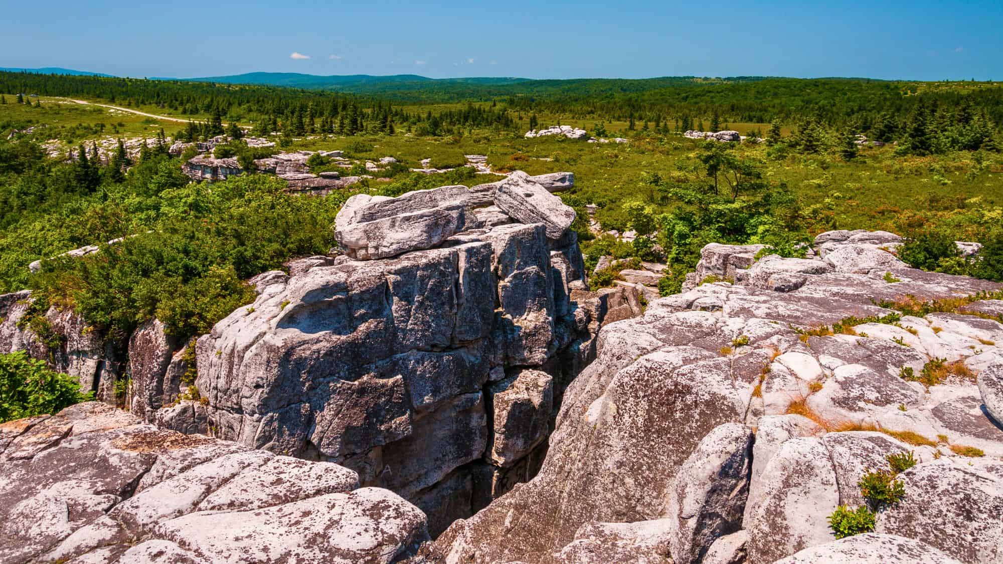
High in the Allegheny Mountains, FR 75 climbs toward Bear Rocks and the Dolly Sods Wilderness, one of the most distinctive landscapes in the East. The gravel road is rough and rutted in places, usually closing from late fall through spring due to snow and thawing conditions. In dry weather, it’s passable by cautious drivers, though high clearance helps when puddles linger.
The ascent reveals striking changes in vegetation, from dense hardwoods to open spruce meadows and windblown heath. And pullouts provide sweeping views across the Canaan Valley, especially near Bear Rocks Preserve, where sandstone outcrops catch the sunrise in dramatic color.
Several trailheads branch off the main route, offering access to miles of backcountry paths where red spruce and huckleberry dominate. Facilities are minimal, so visitors must pack out everything they bring. Because the weather can shift rapidly at 4,000 feet, layers and rain gear are essential.
Salmon-Challis National Forest, Idaho — Yankee Fork Road To Custer Ghost Town

Traveling northwest from Sunbeam, Yankee Fork Road traces the narrow valley of the Yankee Fork Salmon River toward Custer Ghost Town, one of Idaho’s most evocative remnants of the gold rush era. The route is gravel for much of its length, open mainly between Memorial Day and Labor Day when snow no longer blocks the shaded canyons.
As the road climbs, you’ll see relics of 19th-century mining operations scattered across the slopes: rusted dredge machinery, cabin foundations, and interpretive signs explaining the area’s tumultuous boom years. And beyond the ghost town, several short trails lead into the surrounding hills and along the riverbanks where willows line the water.
Because there are no services past Custer, visitors should bring supplies and fill up in Stanley before heading out. Late summer brings warm days and crisp nights, with golden light filtering through lodgepole pines.
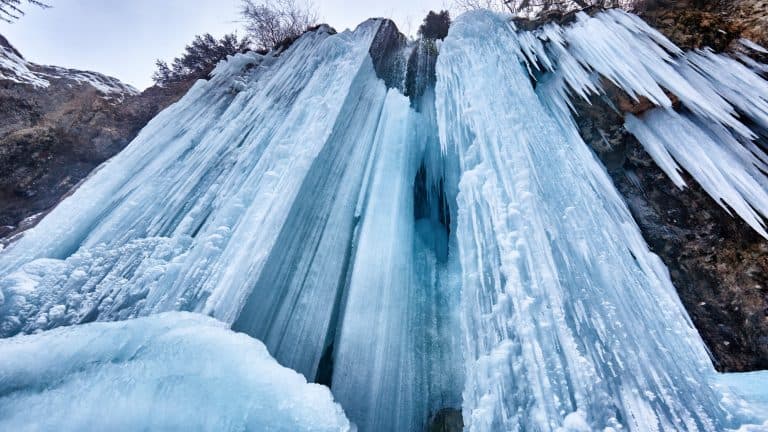
Umpqua National Forest, Oregon — FR 34 To Toketee Falls
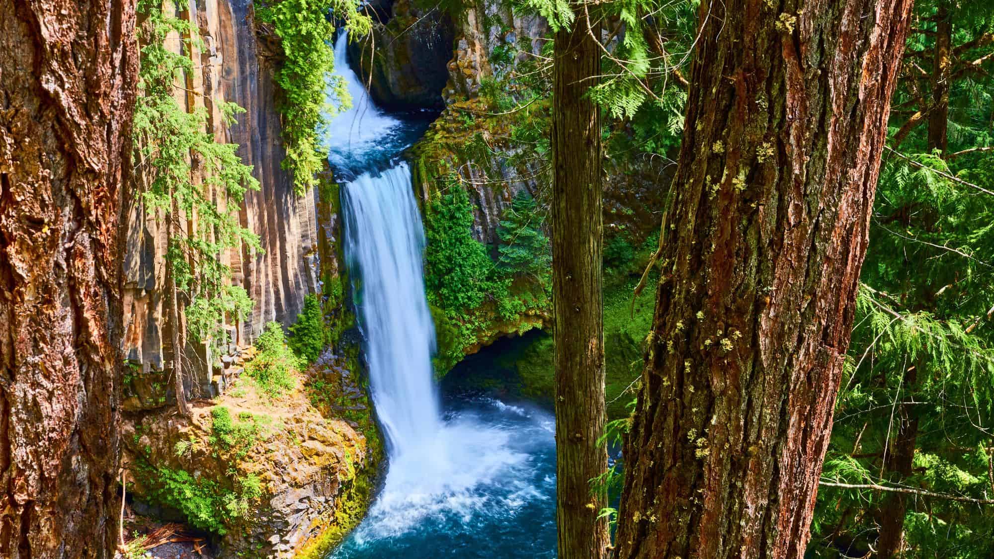
Following the North Umpqua River, FR 34 links Highway 138 to the Toketee Falls area, one of Oregon’s best-known yet still secluded waterfalls. The route is mostly paved, occasionally interrupted by maintenance work or short gravel detours near the 34/3401 junction.
It remains open most of the year, though winter storms can temporarily block access. Driving through the canyon, you’ll cross bridges shaded by maples and Douglas firs. And the air carries a cool mist even in summer, evidence of the river’s steady flow nearby. The road leads directly to Toketee Campground, where a short, well-maintained trail begins its climb toward the viewing platform overlooking the falls.
The columnar basalt amphitheater frames two distinct drops, the lower one spilling into a deep turquoise pool. Because FR 34 parallels several power facilities, closures for construction occasionally occur, so checking the forest’s online alerts helps avoid detours.
Coconino National Forest, Arizona — FR 516/Snowbowl Road To Humphreys Peak Trailhead

Climbing north from Flagstaff toward the San Francisco Peaks, FR 516 (known locally as Snowbowl Road) is paved its entire length and open year-round. Plows keep it clear to the Arizona Snowbowl ski area in winter, though traction tires may be needed after heavy snow.
The Humphreys Peak Trailhead begins directly from the north end of the ski area’s main parking lot, marking the start of the steep route to Arizona’s highest summit at 12,633 feet. In summer, the drive rises through ponderosa pine and aspen forests, where sunlight flickers across the trunks and cool air drifts through open windows.
Autumn brings sweeping hillsides of gold as the aspens turn, drawing photographers from across northern Arizona. And even though the road is paved, it carries a sense of isolation once you climb beyond the last houses on the outskirts of Flagstaff. Just know that parking at the top fills quickly on clear weekends, especially in late spring when the trail first opens after snowmelt.
Gifford Pinchot National Forest, Washington — FR 8303 To Ape Cave

Hidden on the south flank of Mount St. Helens, FR 8303 leads to the Ape Cave entrance, one of the longest lava tubes in North America. The paved spur is usually open from mid-May to late October, with timed-entry reservations required in peak season. When the gate closes from November through mid-May, snow and fallen trees reclaim the road’s silence.
Driving the short forest approach, you’ll pass through dense stands of Douglas fir and western hemlock. And the air cools sharply, signaling proximity to the volcanic slopes above. At the trailhead, a paved parking lot offers restrooms and interpretive panels.
Visitors can descend into the lava tube, where flashlights reveal rippled rock frozen in flow. Above ground, short trails lead to the original eruption fields, now blanketed with ferns and moss. The entire setting feels otherworldly, part subterranean, part rainforest. And because the road remains paved, most passenger vehicles can reach it easily.
Ozark–St. Francis National Forest, Arkansas — Falling Water Rd/FS 1205 To Falling Water Falls
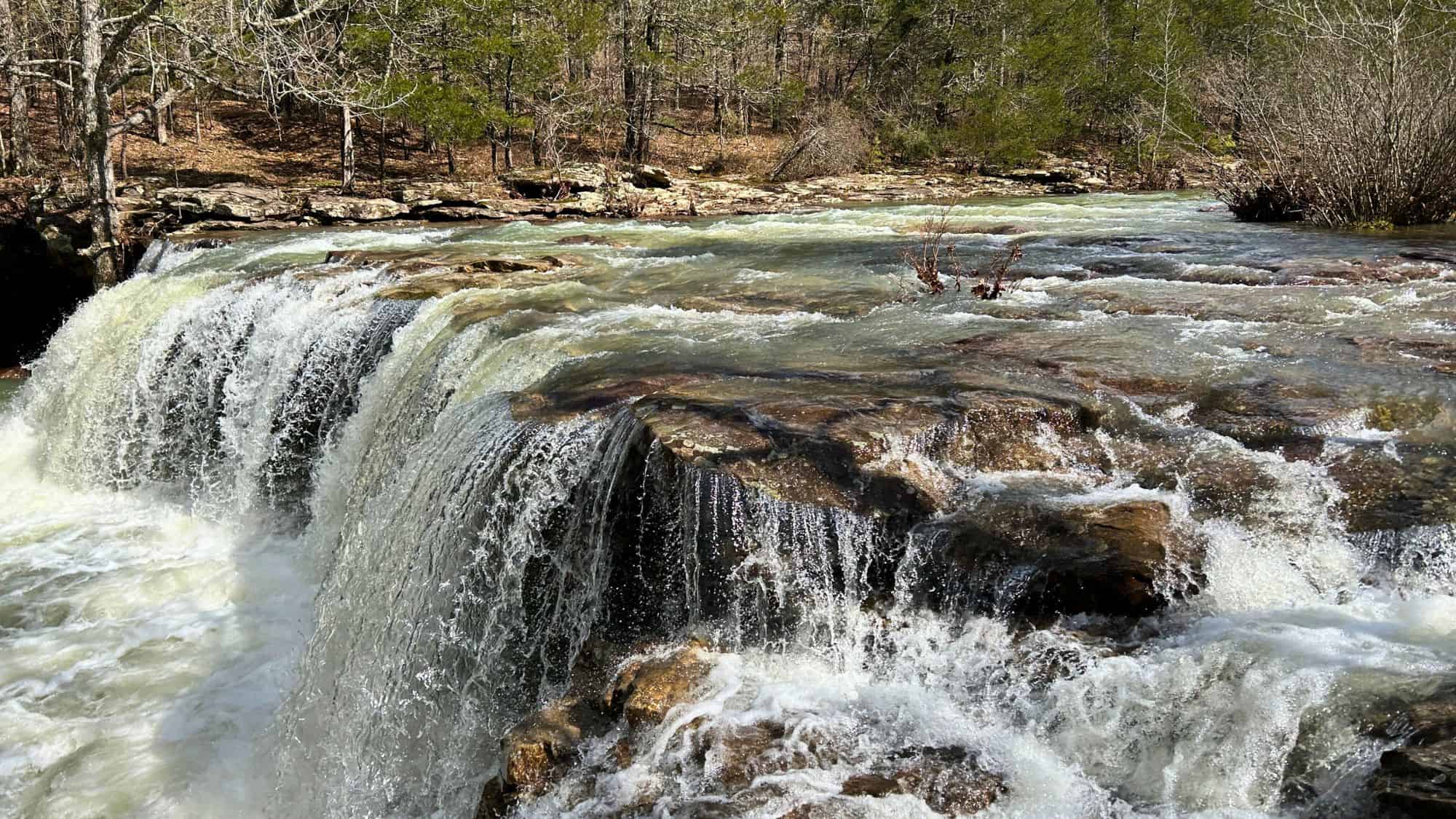
In the rugged heart of the Ozarks, FS 1205, known locally as Falling Water Road, traces the course of Falling Water Creek past one of Arkansas’s most photogenic waterfalls. The dirt-and-gravel route is usually open year-round, narrowing to a single lane in several sections where cliffs press close.
From the small parking turnout, a short path leads down to Falling Water Falls, where clear water drops into a wide pool perfect for cooling off in summer. Upstream, side roads and footpaths reveal additional cascades hidden in the hollows.
The surrounding forest hums with cicadas, and the scent of wet stone lingers after every rain. Although the road has no gates, heavy storms can make it slippery or wash out crossings, so checking conditions is wise. Because it lies far from major highways, traffic stays light even on weekends. And driving slowly along FS 1205 feels less like sightseeing and more like slipping into the quiet rhythm of the Arkansas wilderness.
Tonto National Forest, Arizona — Seven Springs Road/FR 24 To Sears-Kay Ruin
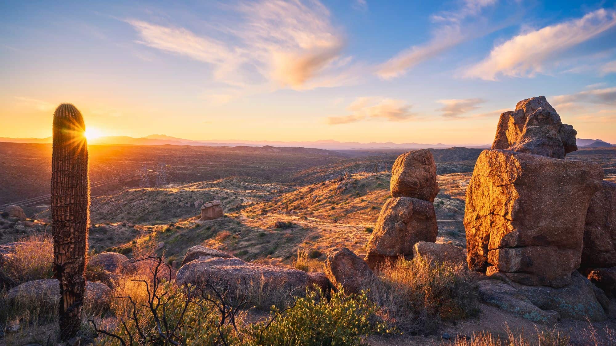
Northeast of Carefree, Seven Springs Road (designated FR 24) winds through desert foothills toward the Sears-Kay Ruin, an ancient Hohokam hilltop village. The route is open year-round except after major storms, when flash floods can carve deep ruts in the washes. Most of the road is graded dirt with scattered washboard sections, manageable for passenger cars if driven carefully.
As you climb through Sonoran desert scrub, saguaros give way to mesquite and juniper, with broad views over rolling hills. The Sears-Kay Ruin itself features a short, paved parking area and an easy half-mile loop trail leading past low stone walls that once enclosed more than 40 rooms. Interpretive signs describe life here nearly a thousand years ago.
Beyond the site, FR 24 continues deeper into the forest toward remote campsites and picnic pullouts beside Seven Springs Creek, where cottonwoods provide rare shade. And late afternoon light brings long shadows across the ridges, turning the dust golden. Even though this road sits within an hour of Phoenix, few visitors venture beyond the pavement, leaving much of Tonto’s northern reaches quiet.
Deschutes National Forest, Oregon — FR 4603 To Tumalo Falls
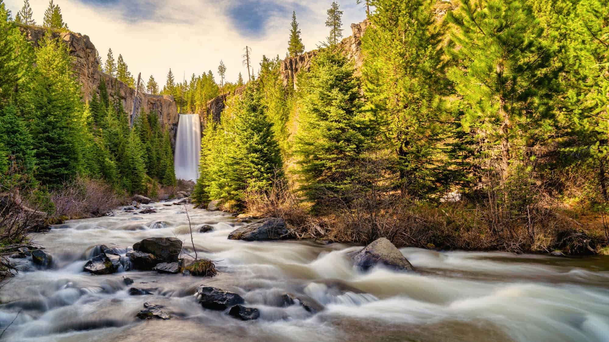
Just west of Bend, FR 4603 serves as the access route to Tumalo Falls, a 97-foot cascade framed by tall pines. The final 2.6 miles are gravel, usually open from late May to early November. During winter, a gate near the snowline closes the road to motor vehicles, and the falls become a destination for snowshoers and cross-country skiers instead.
When open, the drive itself feels short but scenic, following Tumalo Creek through a narrow canyon. The forest thickens as you near the day-use area, where the roar of falling water reaches through the trees. A paved viewpoint offers a clear look at the plunge, and a short trail climbs higher for views of the upper gorge.
Facilities include restrooms and picnic tables, though no food services or fuel are nearby. The road’s gravel section is typically firm, though dust and occasional potholes require slow driving. Summer weekends can bring full parking lots, but weekdays remain peaceful, with sunlight glinting through lodgepoles.
Siuslaw National Forest, Oregon — FS 17 To Drift Creek Falls
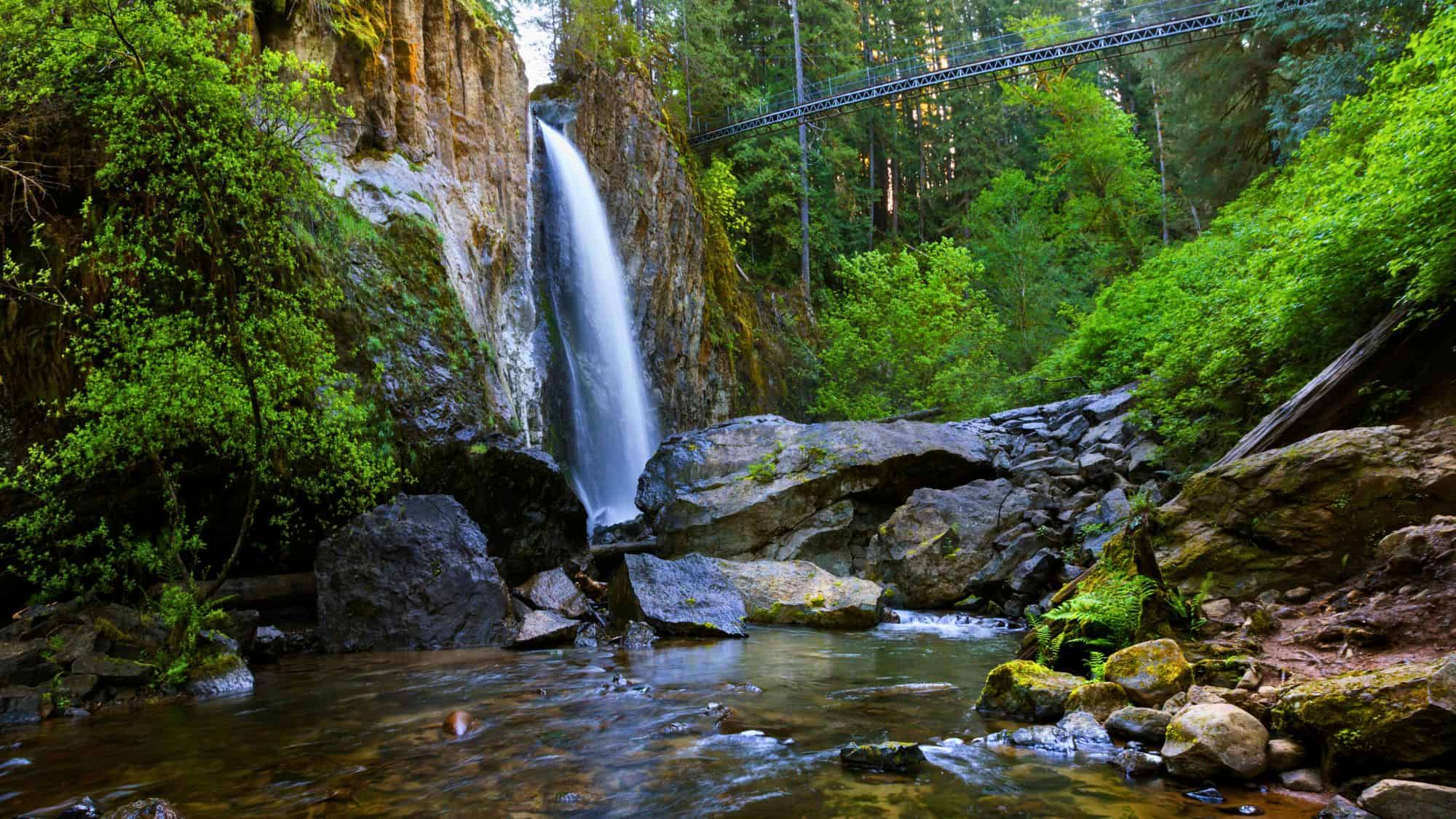
Winding inland from the Oregon Coast near Waldport, FS 17 provides the most direct access to the Drift Creek Falls Trailhead. This gravel forest road climbs steadily through alder groves and thick Douglas fir, occasionally narrowing around sharp corners.
Passenger cars can manage the route, though recent storms sometimes leave ruts or downed limbs. At the trailhead, a small parking area sits amid the trees, often quiet except for distant creek sounds. And the three-mile round-trip trail leads to a 240-foot suspension bridge spanning a deep gorge, with Drift Creek Falls plunging beneath it in a silvery ribbon.
Maintenance crews periodically close FS 17 for grading or culvert repairs, but when open, it’s among the most rewarding short drives in Siuslaw National Forest. And despite its popularity among locals, few travelers from outside the area discover this road because it lacks clear signage from the coast.
Bridger-Teton National Forest, Wyoming — Swift Creek Road To Periodic Spring Trailhead
Near Afton in western Wyoming, Swift Creek Road begins as pavement through ranch country before turning to gravel inside the national forest boundary. The road leads to the Periodic Spring Trailhead, home to one of the world’s few rhythmic springs, where water flows and stops in natural cycles throughout the day.
Summer through early fall offers the best access, as snow can block the upper section in winter. The drive follows Swift Creek, its clear water running beside willows and cottonwoods. The gravel is usually firm, though narrow spots make courteous passing necessary.
At the small trailhead, a half-mile path continues up the canyon to the spring itself, where visitors can watch the flow surge and subside in timed pulses. It’s a quiet, almost meditative sight framed by steep limestone walls. Picnic tables near the parking area invite lingering before the return trip. Though Afton is only a few miles away, the shift from town to forest feels immediate, with cool air and the sound of rushing water replacing traffic noise.
Like Our Content? Make sure to join our newsletter for all the latest on outdoor adventures (and a FREE STARGAZING GUIDE). Click here to sign up!