Discover Parks & Wildlife contains affiliate links and is a member of the Amazon Services LLC Associates Program. If you make a purchase using one of the Amazon links, we may receive compensation at no extra cost to you. We may also use select AI tools to support our creative process, but all content is reviewed, refined, and finalized by our human team. See our disclosure policy and our AI use policy for more information.
11 Stunning Scenic Trails Outside The Big Parks That Make Every Step Worth It
Stepping onto a trail that skirts the edges of fame offers a distinct kind of reward. The most celebrated parks and visitor centers naturally draw crowds, but the land itself does not stop at a drawn boundary. Mountains continue their upward thrust, coastlines keep crashing against the rocks, and deep forests stretch far beyond the paved parking lots.
Finding the paths that weave through these unprotected or lesser-known stretches brings a quieter, more resilient outdoor experience. You find yourself navigating terrain that feels untamed and entirely yours for the day.
The appeal lies in the raw challenge and the unpolished beauty of the route. Some paths carve through dense coastal fogs where the tides dictate your schedule. Others climb high into alpine zones where the air thins and the tree line drops away completely.
The preparation requires a bit more focus, and the trails demand a higher level of self-reliance. Without the infrastructure of a massive tourist hub, you rely on your own timing and physical readiness. But the payoff comes in uninterrupted sightlines and the simple rhythm of putting one foot in front of the other across miles of varied, demanding landscapes.
Kalalau Trail, Hawaii
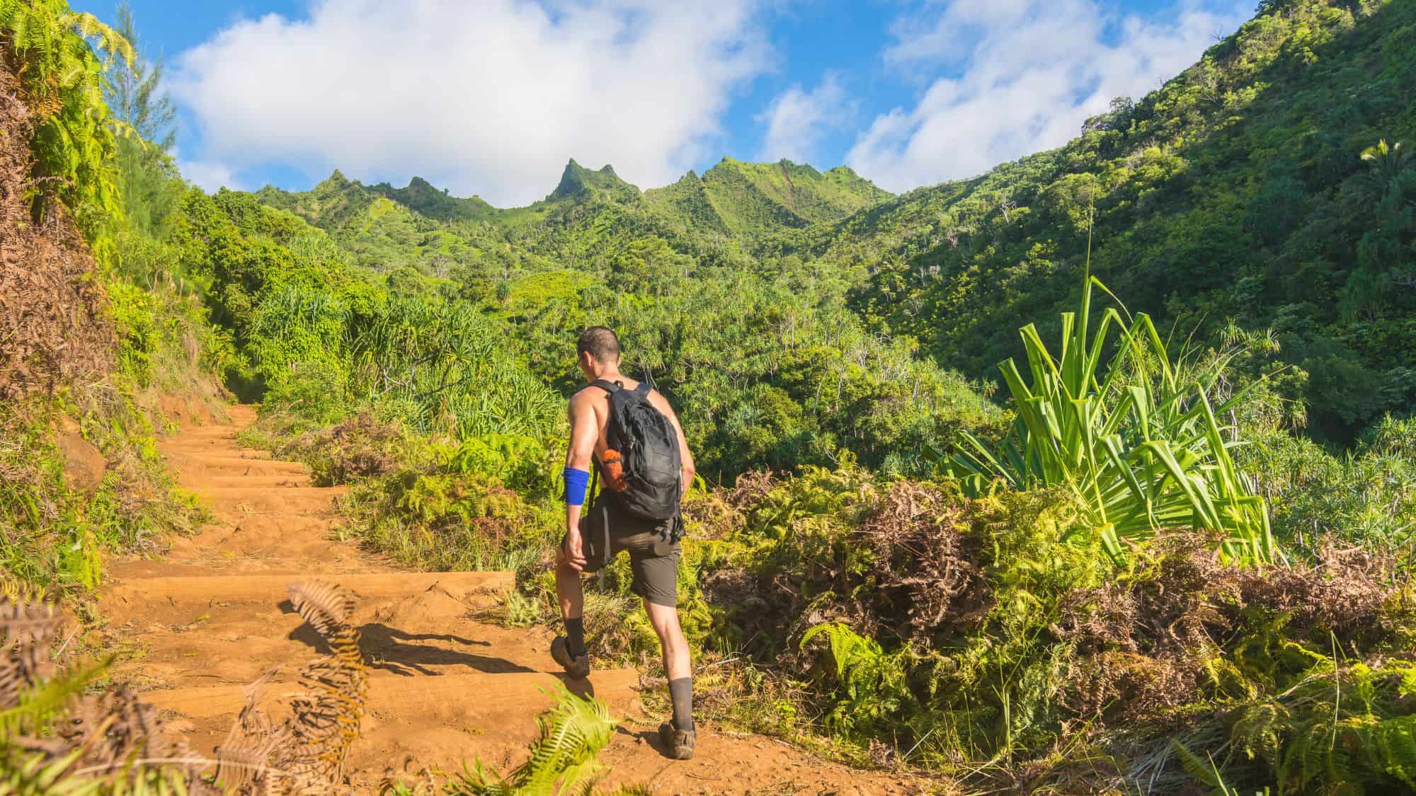
The Kalalau Trail carves a rugged path along the Na Pali Coast of Kauai. This route stretches 11 miles one way, totaling just about 22 miles for the full round trip. Hikers face significant elevation changes as the path repeatedly drops to sea level and climbs hundreds of feet up the steep sea cliffs.
You will navigate narrow dirt paths, exposed rocky edges, and multiple stream crossings that can swell quickly during heavy rains.
The heat and humidity add another layer of difficulty to the physical exertion. Carrying a heavy pack in a tropical climate means you need to prioritize water purification and hydration at all times. The valleys provide access to fresh water streams, but treatment is absolutely necessary before drinking.
The trail culminates at Kalalau Beach, a remote stretch of sand backed by towering fluted cliffs. The trail also requires a permit for anyone going beyond the first two miles to Hanakapiai Beach.
Start your hike before sunrise to avoid the midday heat and to secure a parking spot at the trailhead. This early start also gives you the best chance of clear views before the afternoon clouds gather around the high peaks.
Lost Coast Trail, California
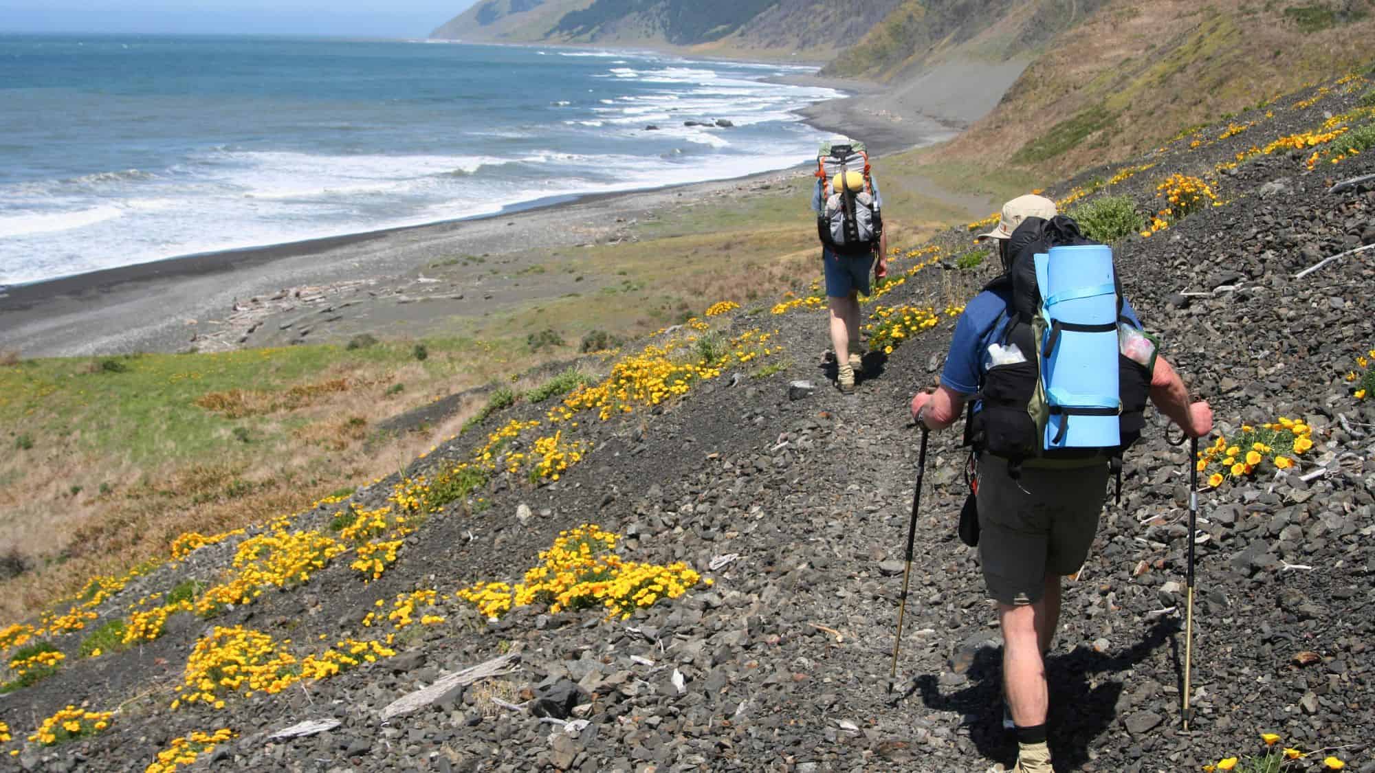
Northern California hides a stretch of shoreline so rugged that highway builders had to route the coastal road miles inland, and the Lost Coast Trail runs for 25 miles through the King Range National Conservation Area.
This is not a typical packed-dirt hike. You will spend miles walking on soft sand, loose gravel, and slippery ocean boulders. The elevation gain remains minimal, but the uneven surface slows your pace significantly.
Tidal zones dictate your entire schedule on this route. Several sections of the beach completely disappear under the water at high tide, trapping hikers against impassable cliffs. You must carry a printed tide chart and know exactly how to read it to safely pass these narrow bottlenecks. Bear canisters are also required, as the area sustains a healthy black bear population.
Plan to hike from north to south, starting at Mattole Beach and ending at Black Sands Beach. This direction puts the prevailing winds at your back, pushing you along the coast rather than fighting you every single step of the way. Packing a durable windbreaker makes the exposed beach walking much more comfortable.
Superior Hiking Trail, Minnesota
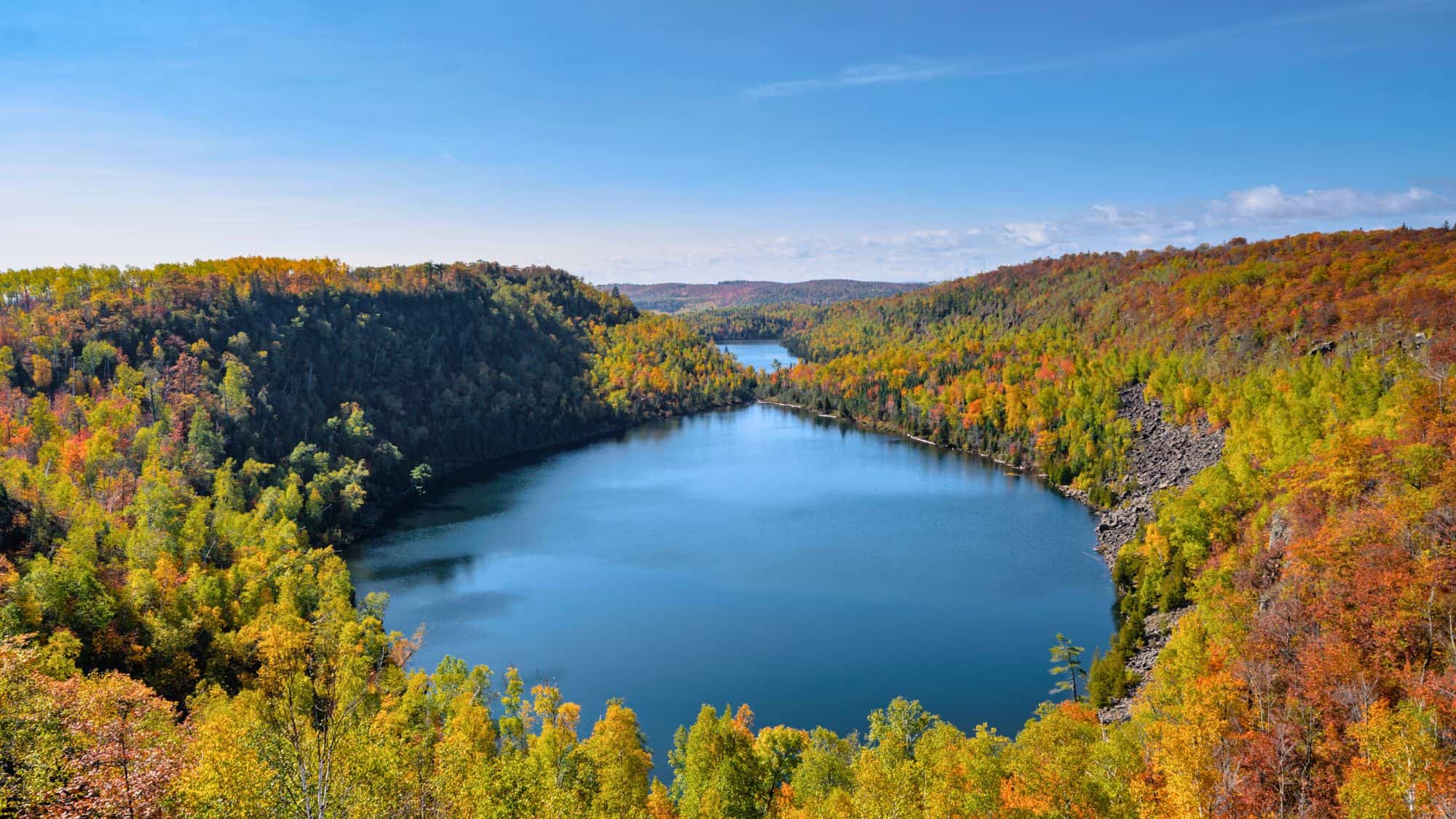
The Superior Hiking Trail stretches across the rocky ridges overlooking Lake Superior. At its lowest point, the trail dips to 602 feet above sea level. It eventually climbs to its highest point at 1,829 feet, sitting more than 1,200 feet above the massive lake below.
The 284-mile path (though you can do just a small section) cuts through dense birch and pine forests, crossing numerous fast-flowing rivers that tumble down toward the shore. The terrain also features constant short, steep climbs and descents rather than long, sustained mountain passes.
The trail association maintains distinct backcountry campsites that do not require advance reservations, operating on a shared-site system. This makes logistics easier for long-distance hikers who cannot predict exactly where they will end their day.
Fall offers the best hiking window. The temperatures drop to a comfortable level, the mosquitoes disappear, and the maple trees turn bright red. Bring a warm sleeping bag, as nighttime temperatures in northern Minnesota can plummet unexpectedly even during the warmer months.
Art Loeb Trail, North Carolina
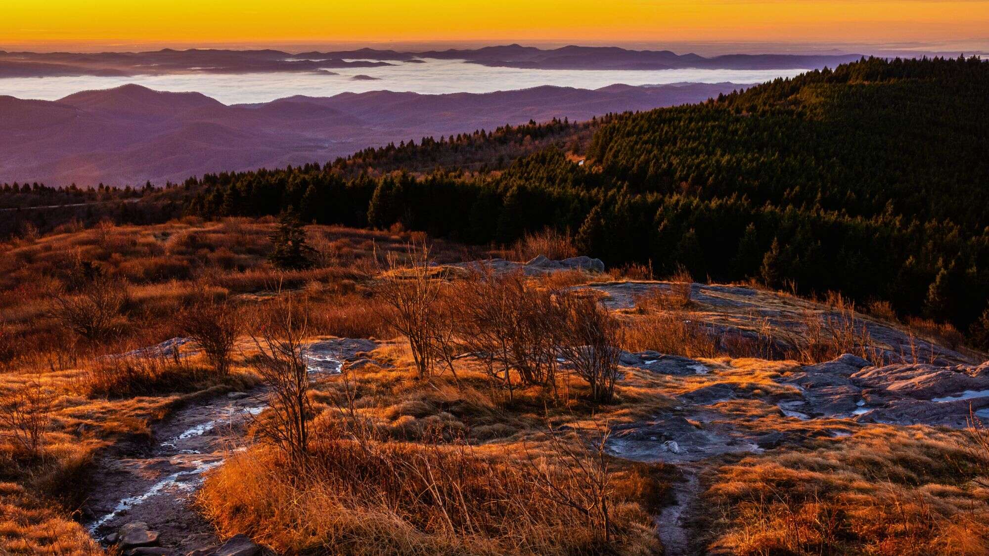
The Art Loeb Trail covers 30 miles of steep, challenging terrain in the Pisgah National Forest. It serves as a tribute to Arthur Loeb, a dedicated conservationist.
The path crosses four distinct peaks, taking you through some of the most striking landscapes in Western North Carolina. The southern section features a relentless climb out of the Davidson River valley, testing your endurance right from the start.
Once you reach the higher elevations, the trail opens up across the Black Balsam Knob area. This section lacks tall trees, providing sweeping, unobstructed views of the surrounding Appalachian ridges. But the weather at 6,000 feet changes rapidly, bringing sudden thunderstorms and thick fogs that can disorient hikers in the open meadows.
Navigating the Shining Rock Wilderness portion requires strong map skills, as wilderness regulations prohibit blazing and trail markers.
Pack layers to handle the wind chill on the exposed balds, and always keep a physical map and compass handy to stay on the correct path.
Teton Crest Trail, Wyoming
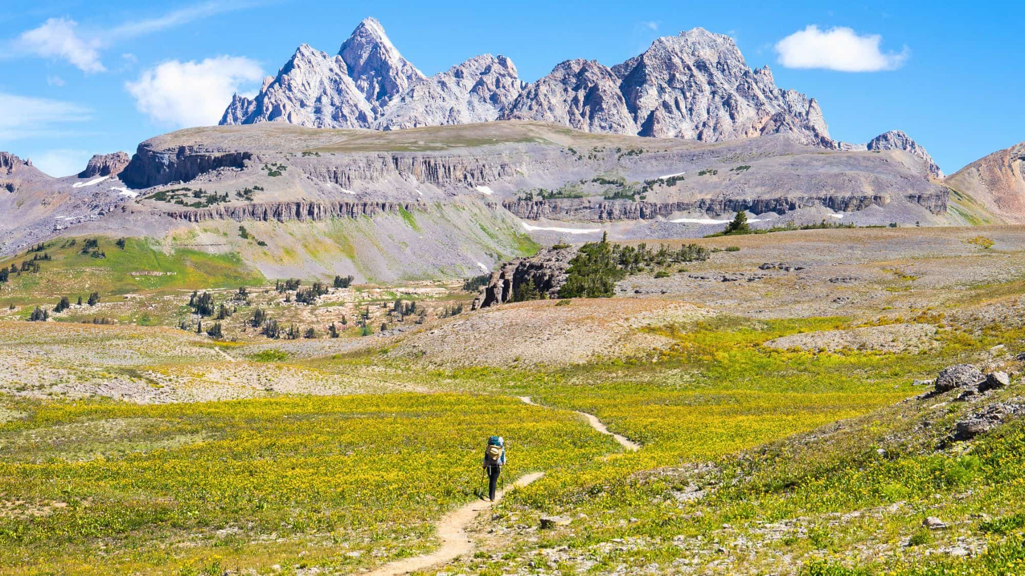
The Teton Crest Trail keeps you at high altitude for the majority of its length. Hikers typically spend three to five days completing the 40-mile route.
You will traverse exposed alpine shelves, deep glacier-carved canyons, and high mountain passes. Because parts of the trail cross through national forest land outside the main park boundaries, you can experience a slightly different set of regulations depending on where you pitch your tent.
The route requires a bear canister for all food storage. Grizzly and black bears roam heavily throughout these mountains, making proper food handling a strict requirement.
Snow can linger on the high passes well into July, requiring an ice axe and traction spikes for safe crossing early in the season. Securing a permit takes advanced planning, but the effort pays off when you see the jagged granite peaks from the western slope.
Start your hike from the aerial tram at Teton Village to bypass a massive initial climb. This strategy saves your legs for the sustained elevation of the crest itself, where the oxygen is thinner.
Wonderland Trail, Washington
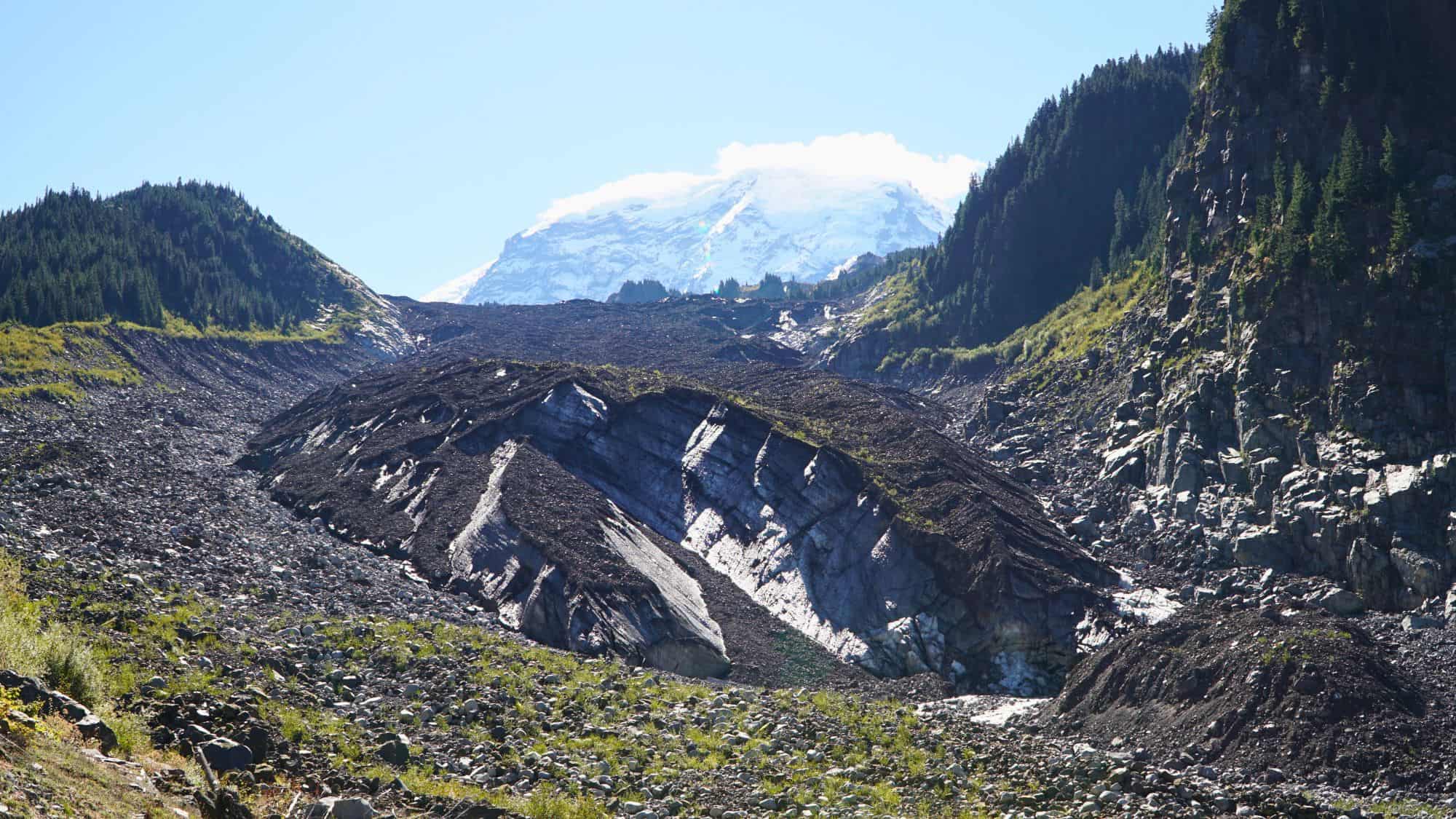
The Wonderland Trail creates a complete 87-mile circle around Mount Rainier. Hikers face a massive physical challenge, dealing with approximately 25,000 feet of elevation gain over the course of the loop.
The path constantly dips into deep river valleys only to climb straight back up to high alpine ridges. You will cross suspension bridges over glacial rivers, walk through dense old-growth forests, and navigate rocky moraines below massive ice fields.
Securing a permit requires entering a highly competitive lottery system early in the year, and the trail typically takes seven to twelve days to finish, demanding strict itinerary planning for your designated campsites.
The weather often shifts from intense sun to freezing rain within hours. Bring a highly waterproof shelter and reliable rain gear. Pay close attention to the log bridges over glacial streams, as afternoon snowmelt can cause the water levels to rise dramatically.
Sturdy trekking poles will help protect your knees on the punishing, thousands-of-feet descents that happen almost every single day.
Devil’s Path, New York
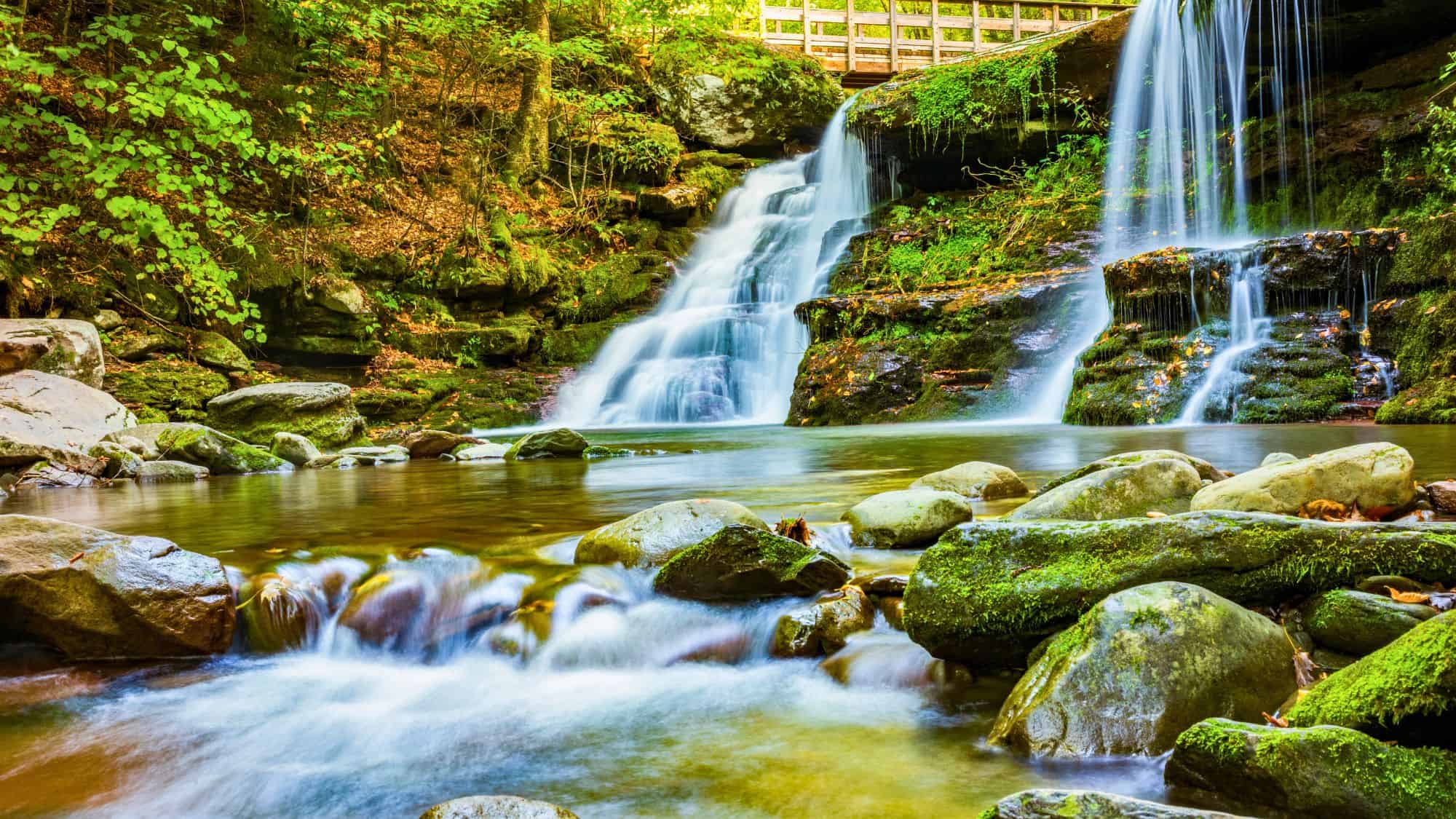
Devil’s Path earns its intimidating name with brutal, unforgiving terrain. Located in the Catskill Mountains, this 22-mile route features climbs straight up the fall lines of six different mountains.
You will not find gentle switchbacks here. Instead, you face near-vertical rock scrambles where you must use your hands to pull yourself up over slick, algae-covered ledges.
Water sources are notoriously unreliable along the high ridges. You must drop down steep side trails to find springs, adding even more elevation to an already exhausting day. And the dense forest canopy blocks out most of the sun, keeping the rocky path damp and slippery long after a rainstorm.
The trail is heavily populated with black bears, making proper food hangs or bear canisters necessary at night.
Because of the extreme physical toll, many hikers split the route into two or three days. If you attempt it, wear hiking boots with deep, aggressive traction to grip the wet roots. Start your days early, as the thick tree cover makes the forest floor go dark well before sunset.
Mount Lafayette And Franconia Ridge Loop, New Hampshire
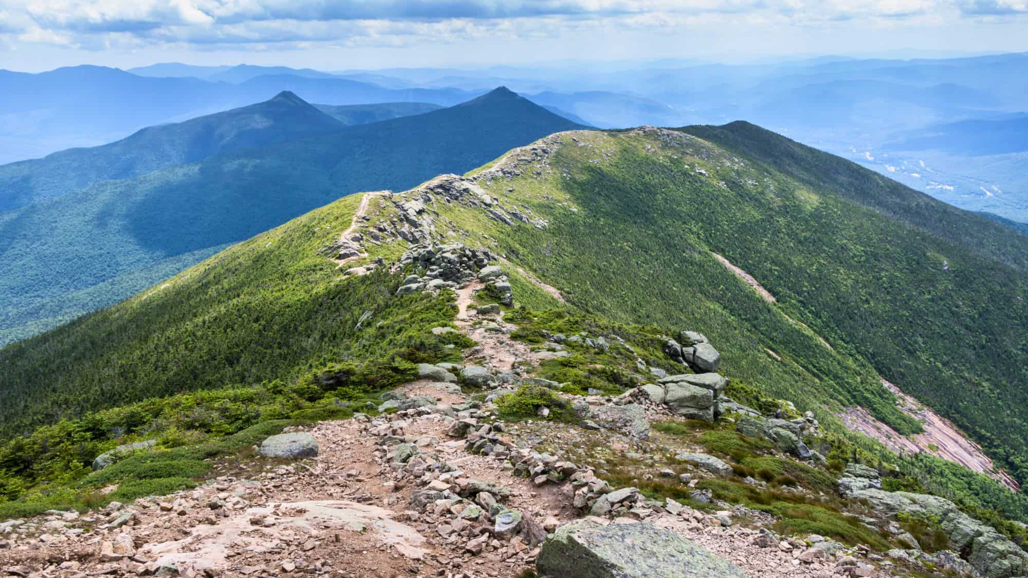
The Franconia Ridge Loop stands as a premier day hike in the White Mountains. The route covers nearly 9 miles and demands roughly 3,800 feet of climbing. You will ascend Mount Lafayette, Mount Lincoln, and Little Haystack Mountain.
A significant portion of this loop keeps you entirely above the tree line. Once you reach the ridge, the path narrows to a rocky spine with massive drops on either side, offering incredible views of the Pemigewasset Wilderness.
The weather on the ridge is notoriously volatile and dangerous. High winds, plunging temperatures, and sudden storms can create life-threatening conditions even in the middle of summer. You must check the Mount Washington Observatory weather forecast before you start the climb. If clouds cap the peaks, the wet rocks become incredibly slick.
Start your hike up the Falling Waters Trail to tackle the steepest, wettest section while your legs are fresh. This direction also brings you past beautiful cascades early in the morning. And don’t forget to pack a warm fleece and a windproof shell, no matter how hot the parking lot feels when you leave your car.
Four Pass Loop, Colorado
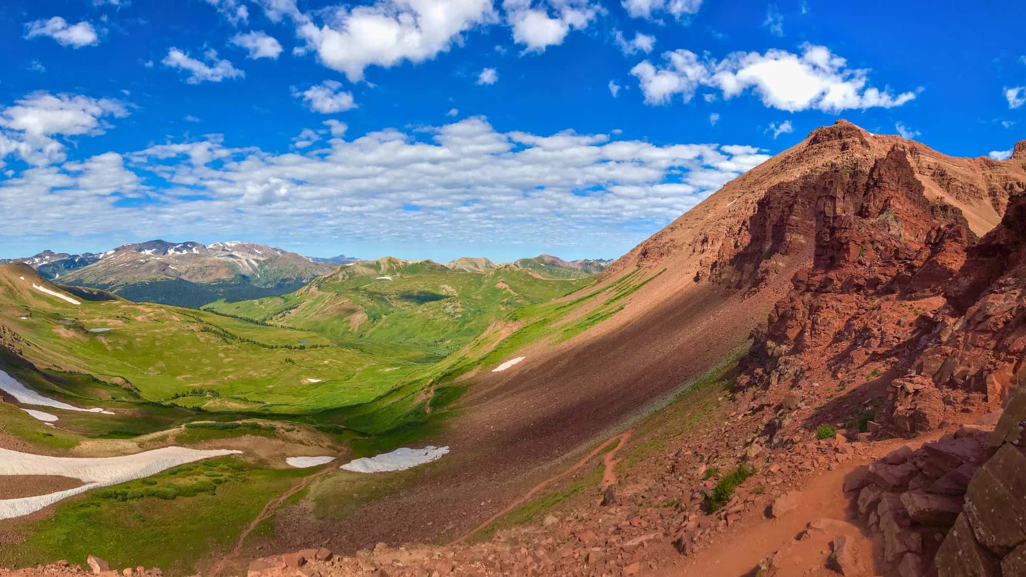
Four Pass Loop takes hikers through the heart of the Maroon Bells-Snowmass Wilderness. This 27-mile circuit crosses four distinct mountain passes, each towering over 12,000 feet.
The trail cuts through dense aspen groves, wide alpine basins, and fields of sharp scree. The altitude demands respect, often causing shortness of breath and headaches for those who do not spend time acclimatizing before the trek.
Thunderstorms arrive with intense regularity in the Colorado Rockies. So you must plan your hiking schedule to cross the exposed high passes before noon, as afternoon storms are more likely than morning. Lightning strikes are a severe danger above the tree line.
Permits and parking reservations are required to access the trailhead at Maroon Lake. Parking at the Aspen Highlands lot and taking the public shuttle provides the easiest access.
Eagle Creek Trail, Oregon
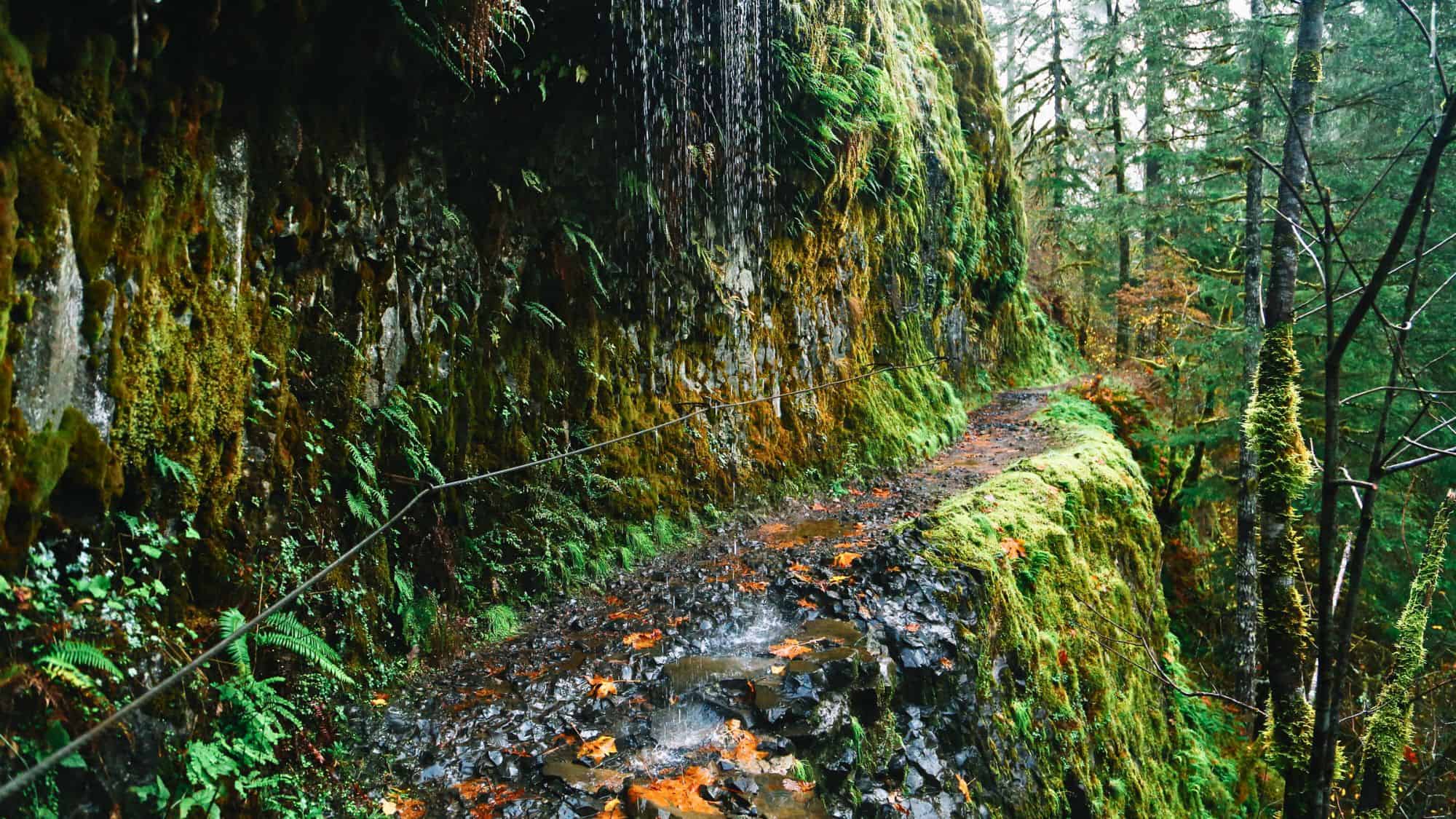
Eagle Creek Trail cuts directly into the basalt cliffs of the Columbia River Gorge. This path provides a close-up look at the dramatic geology of the Pacific Northwest. You will hike 26 miles through a deep, mossy canyon past multiple towering waterfalls.
The most famous destination on this route is Tunnel Falls, located about 6 miles from the trailhead. The trail literally passes through a tunnel in the rock directly behind the falling water.
Along the path, you will find yourself walking on the side of vertical cliffs, creating steep drop-offs right next to your feet. Steel cables are anchored into the rock wall in the narrowest sections to provide a handhold. So this hike is not recommended for anyone with a severe fear of heights. Also be aware that the rocks stay wet from the constant spray of the waterfalls, making the footing treacherous.
Arrive at the trailhead before sunrise on weekends to secure parking, as the lot fills up incredibly fast. Wear a rain jacket to stay dry when passing behind the falls, and keep a tight grip on your gear when navigating the narrow cliff-side sections.
Turtlehead Peak Trail, Nevada
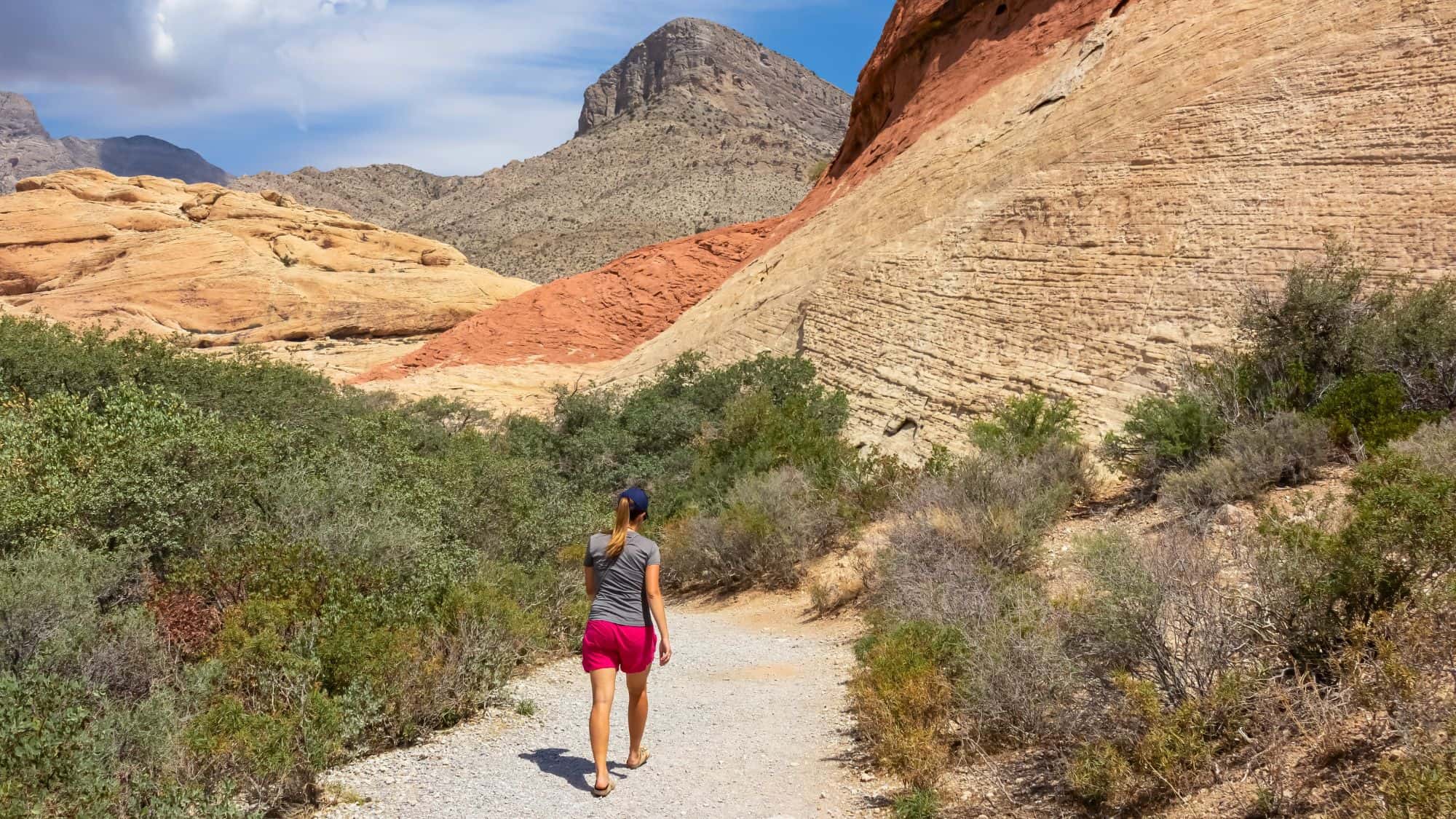
Turtlehead Peak rises prominently out of the Red Rock Canyon National Conservation Area. The trail runs for just under 5 miles round trip, but do not let the short distance fool you. The hike features a grueling 2,000 feet of climbing.
The second half of the route requires scrambling up a steep, loose gully of scree and shattered sandstone. Every step forward often results in sliding half a step backward in the loose rocks.
The Mojave Desert environment also presents a serious environmental challenge. The best window for this hike is from late fall through early spring. If you attempt this in the warmer months, you must start at first light and be off the mountain before ten in the morning. The lack of shade and radiating heat from the rocks can quickly lead to heat exhaustion.
The reward? The summit offers a direct, sweeping view of the Las Vegas Strip sitting far below in the desert basin. Just remember to wear sturdy hiking boots with good ankle support to protect yourself from twisting an ankle on the unstable rocks near the top.
Like Our Content? Follow Us on MSN (or click the Follow Button above) for more from Discover Parks & Wildlife.