Discover Parks & Wildlife contains affiliate links and is a member of the Amazon Services LLC Associates Program. If you make a purchase using one of the Amazon links, we may receive compensation at no extra cost to you. We may also use select AI tools to support our creative process, but all content is reviewed, refined, and finalized by our human team. See our disclosure policy and our AI use policy for more information.
Found By Accident contains affiliate links and is a member of the Amazon Services LLC Associates Program. If you make a purchase using one of the Amazon links (or other affiliate links), we may receive compensation at no extra cost to you. See our disclosure policy for more information.
12 Utterly Epic Road Trip Routes in Places You Rarely Think to Explore
The great American road trip pulls travelers across the country, but there’s a quiet world beyond the busiest highways. Instead of jostling with lines of cars along the coasts or tracking down the famous photo stops, these often-overlooked backroads invite you to rediscover landscapes that are just as stirring (sometimes more so) without the crowds.
Here, sprawling prairies ripple beneath cloud-rushed skies. Deep forests breathe cool air across the hood of your car. Mountain passes rise and dip with hairpin drama.
These routes reach into the heart of small towns, the open wild, and national treasures missed by those sticking to the interstates. Expect stretches with almost no cell service, seasonal quirks, and an authentic, at-your-own-pace appeal.
Each of the following drives rewards you with distinct character, natural spectacle, and a sense of genuine adventure. You’ll find chances to pause in historic villages, walk through fragile habitats, catch sight of eagles or bison, and linger in places that remain beautifully unhurried.
Flint Hills Scenic Byway – Kansas
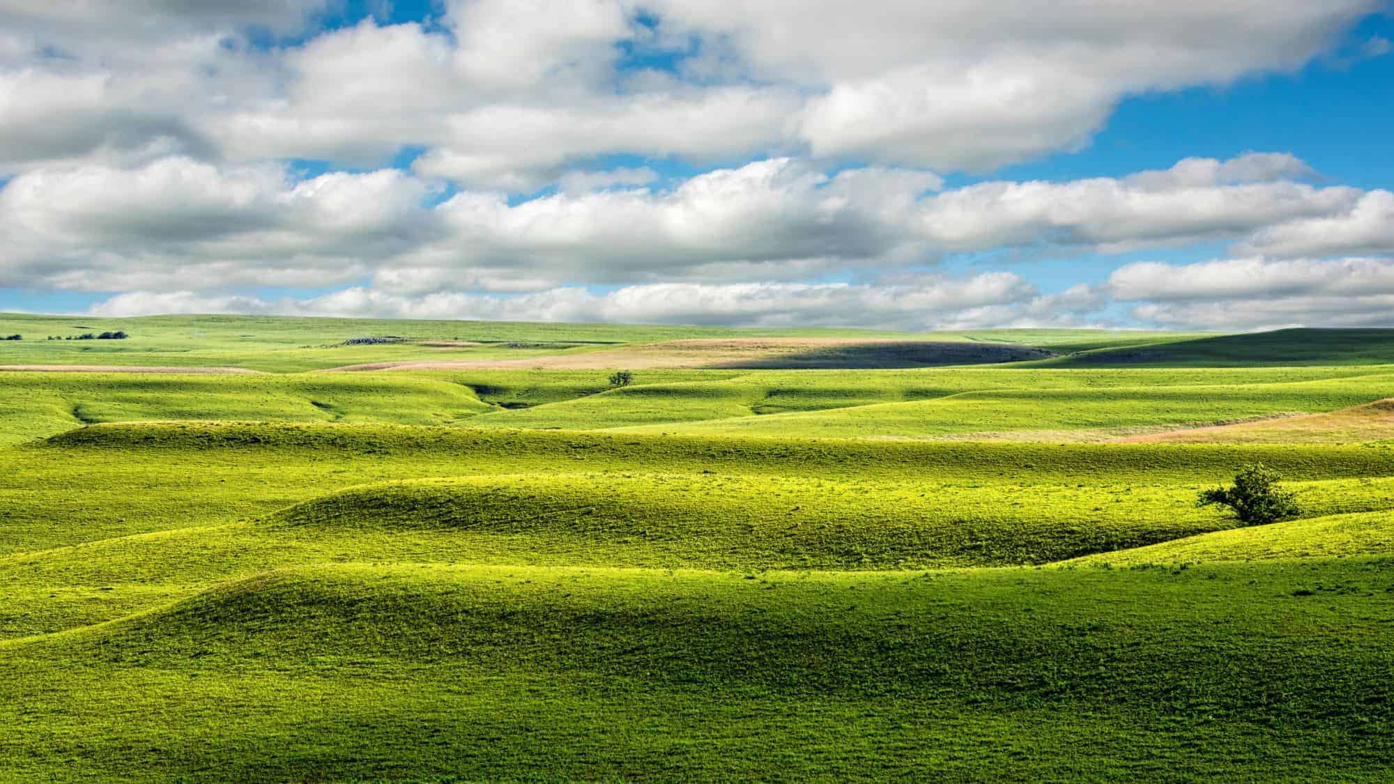
The Flint Hills Scenic Byway unspools through a landscape found almost nowhere else on earth – the tallgrass prairie, which once stretched across much of North America but now endures only in small pockets.
This 47-mile ribbon of highway, known as Kansas 177, gently rises and falls over wind-swept hills capped with a signature “flint” rock, their surfaces carpeted in resilient native grasses. The scale here is quiet but vast, with wildflowers painting the spring hillsides in soft purples and golds, and controlled burns in late winter and early spring leaving brief, smoky echoes across the horizon.
Bison can occasionally be spotted in the Tallgrass Prairie National Preserve, a working ranch and critical wildlife refuge that offers self-guided and ranger-led walks, allowing you to step into grass sometimes higher than your head.
Council Grove, one of the byway’s anchors, displays the layered history of the region, from limestone buildings to landmarks tracing the old Santa Fe Trail. Pause to wander the quiet, brick main street, chat with shop owners, and savor homemade pie at a local café.
The highway’s solitude, only occasionally interrupted by a distant tractor or grazing cattle, gives the drive a grounding sense of openness and time-travel. Every stop, whether a scenic overlook or an interpretive sign, underscores the rare natural and cultural heritage preserved among these softly rolling Kansas hills.
Brockway Mountain Drive – Michigan
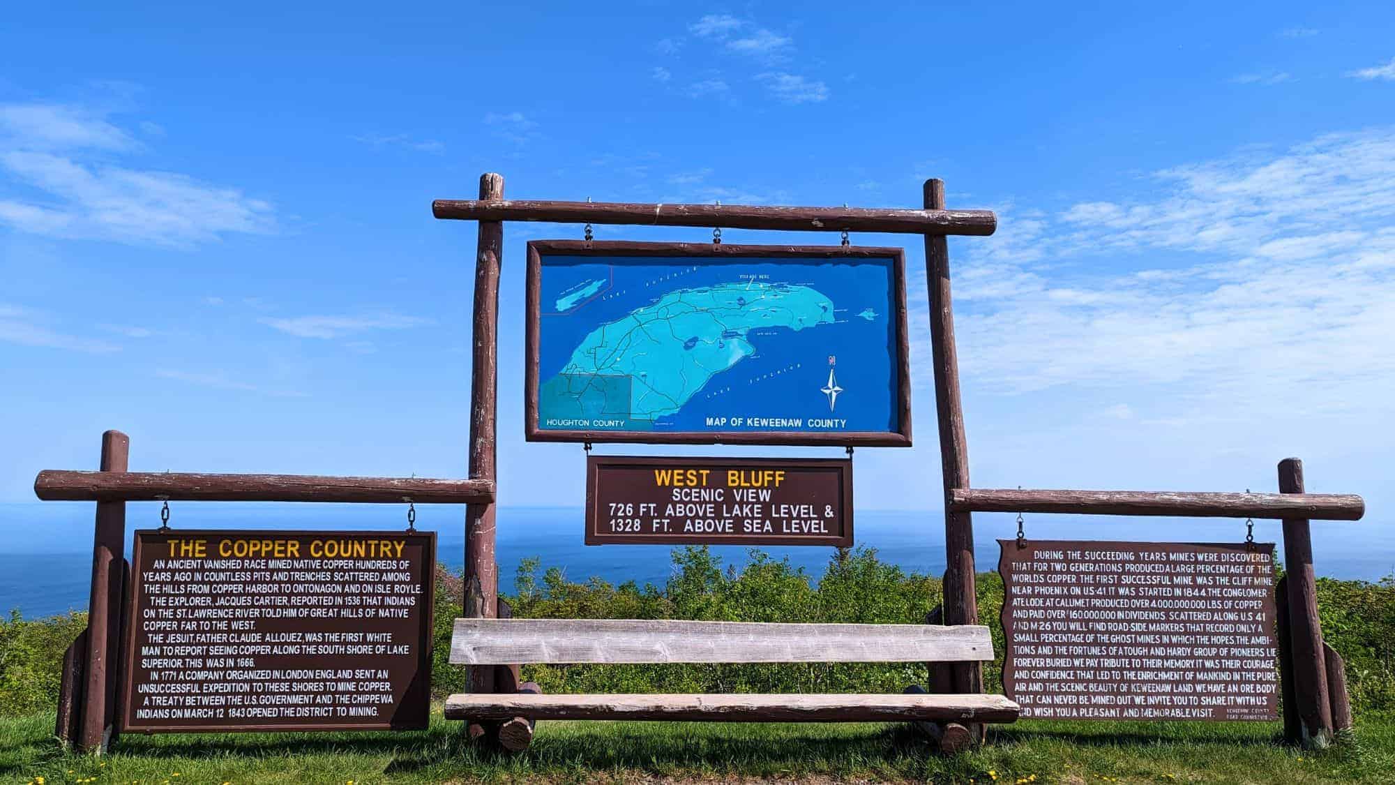
Brockway Mountain Drive snakes up the Keweenaw Peninsula, serving up some of the Midwest’s most dramatic scenery in under ten miles. As you begin the winding ascent into the Upper Peninsula’s backcountry, the trees peel away to reveal bold, blue Lake Superior stretching to the horizon.
The road itself is an engineering feat, reaching the highest point accessible by car between the Rocky and Allegheny Mountains at 1,328 feet. Each scenic pullout gives a changing view: forest mosaics, rugged outcroppings, glimpses of remote Copper Harbor far below, and the unique shape of Isle Royale National Park on clear days (nearly 50 miles across the water).
In spring, the mountain becomes a migration watchpoint, with birders peering skyward as broad-winged hawks, eagles, and other raptors funnel past on their seasonal journey north. And fall transforms the landscape into a fiery sweep of maples, birch, and aspen, the colors so vivid that even overcast days seem to glow.
Copper Harbor, at the mountain’s eastern base, maintains a historic, low-key vibe: find a lighthouse tour, hike to waterfalls twisting through basalt rock, or rent a bike to sample the area’s renowned mountain trails. With little traffic and plenty of places to pull over, Brockway Mountain Drive gives you the flexibility to savor the open air and surprising beauty of Michigan’s wild north.
Voyageurs Highway – Minnesota

Northern Minnesota holds surprises beyond what the maps reveal, and the Voyageurs Highway unlocks a world where land and water blend seamlessly.
The highway roughly follows Minnesota 11, tracing the storied route of French-Canadian voyageurs who powered furs and supplies across these lakes centuries ago. Here, the road is a bridge to one of North America’s least developed national parks: Voyageurs.
Unlike parkways filled with overlook turnouts, this highway feels purpose-built for true exploration, with multiple points to pause, descend to the water, and trade asphalt for a paddle. Rent a canoe or a houseboat from International Falls, Kabetogama, or Crane Lake. Each is a gateway to interconnected waterways rich in loons, bald eagles, otters, and, occasionally, black bears wandering the near-shore woods.
Though the drive itself is often calm and lightly trafficked, you’ll pass reminders of the remote history, like hand-painted signs for smoked fish, tiny churches, old trading posts.
This region’s seasons are strong and defining: summer brings endless blue water under long daylight, while autumn cloaks the north woods in an explosion of golds and reds. Pull over for a picnic beside a placid bay, spot the hum of distant outboards, and listen for the ancient trill of loons.
Fundy Trail Parkway – New Brunswick, Canada
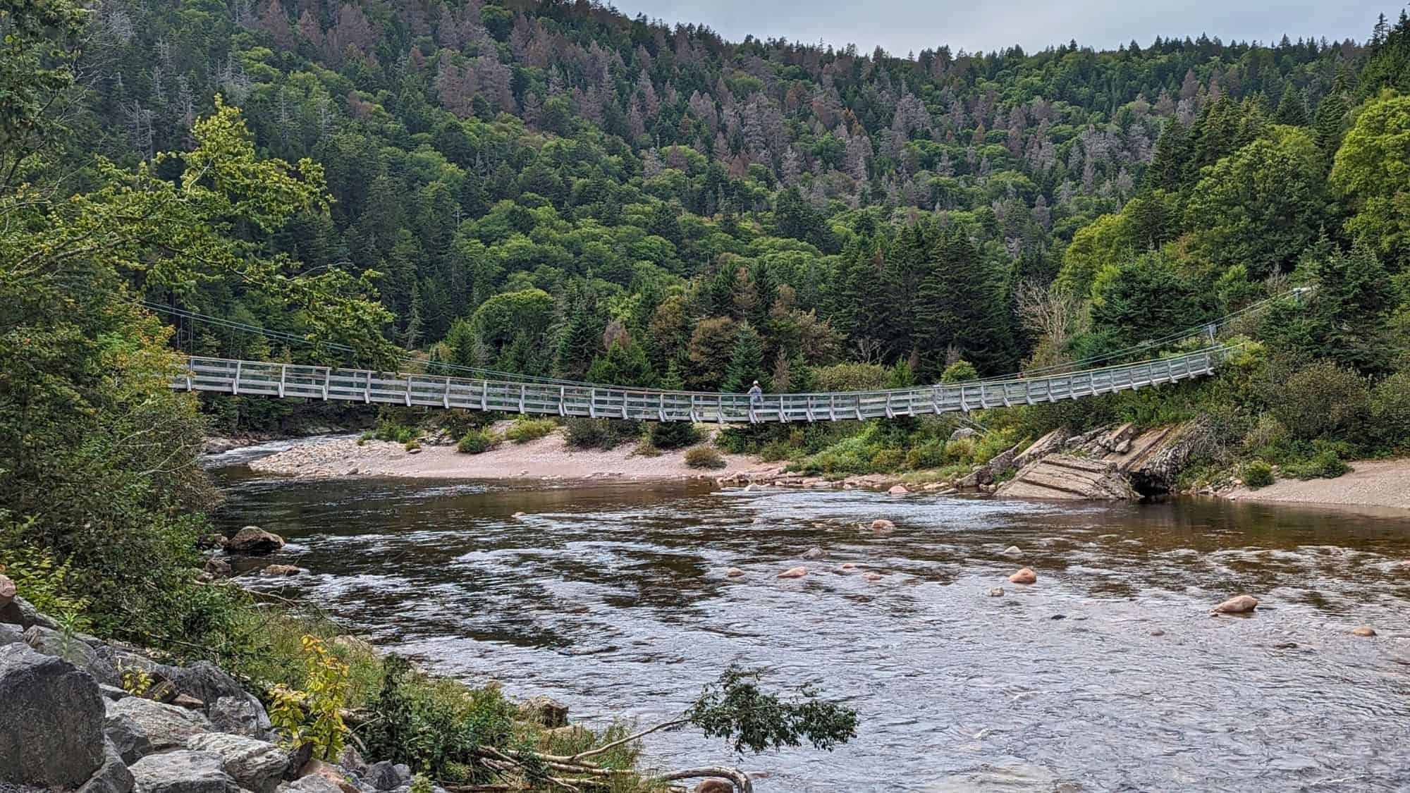
One of Canada’s best-kept secrets, the Fundy Trail Parkway, reveals the untamed character of the Bay of Fundy’s southern coastline. It’s a place shaped by the tidal extremes that define it as one of the world’s greatest natural wonders.
Spanning 19 miles through protected forest, windswept cliffs, and lush valleys, the parkway is purposefully developed for both cars and curious travelers who want to move at their own pace. Pullouts and trailheads dot the route, granting access to observation decks, suspension bridges (notably over Big Salmon River), and hidden shores where tides rise and fall by as much as 50 feet between low and high.
In peak summer, the forest comes alive with the perfume of balsam fir and the shimmer of birch leaves; foggy mornings transform outlooks into ethereal scenes, making for unforgettable, ever-changing views.
Tide tables dictate adventure here, with some beaches only exposed for a slim window, letting you walk where fish swam just hours before. Interpretive centers and signs unpack the area’s unique geology and the rich mix of Acadian and Loyalist history.
Wildlife abounds, too: keep your eyes peeled for bald eagles, porpoises, and even the occasional black bear wandering the quieter sections.
Skyline Drive – Colorado
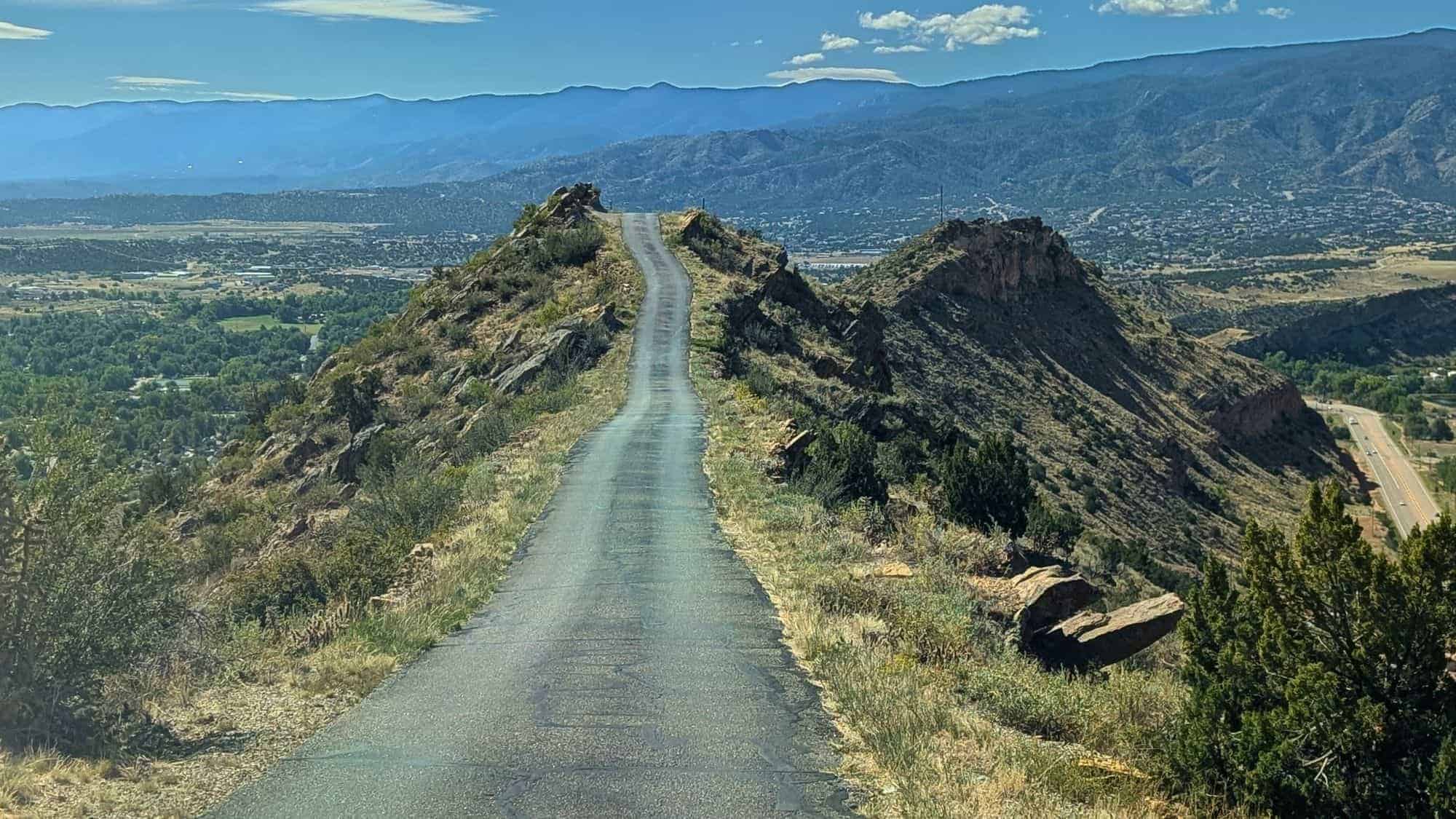
Rising above Canon City, the short but exhilarating Skyline Drive comes with a warning: this is not your average mountain road. Spanning just under three miles, it’s a tightly woven, narrow track tracing a razor-thin ridge, sometimes only wide enough for a single car’s width.
Built in the early 1900s (by prison labor, no less), Skyline Drive rewards the cautious traveler with stark 360-degree views of the Arkansas River Valley and distant Rocky Mountain backdrops. There are no guardrails along long stretches, so drivers feel a thrilling sense of exposure, with sheer drops on both sides and the road tilting daringly against the sky.
Pull off halfway to see dinosaur footprints pressed into ancient rock, marked by subtle signs and easily missed if you’re not watching for them.
In clear weather, you’ll spot the checkerboard streets of Canon City below, as well as the distant bulk of the Wet Mountains. Locals use the route as a quick thrill or the perfect place for a sunset drive; dusk brings a hush and colors that shift from gold to pink across the valley.
After your descent, nearby attractions (Royal Gorge Bridge, whitewater rafting, local microbreweries) make for strong excuses to linger in this lesser-known patch of southern Colorado. Just remember to plan your visit for calm days, as strong winds atop the ridge can add a dose of extra adrenaline.
San Juan Skyway – Colorado
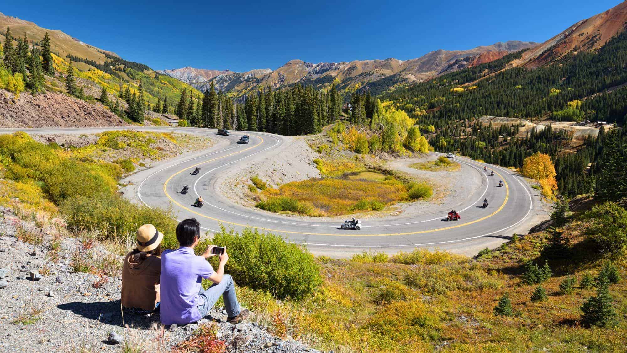
If you crave a winding route packed with alpine drama, the San Juan Skyway delivers from beginning to end. Completing this 236-mile loop is like threading through a living postcard, connecting old mining towns and some of Colorado’s most storied mountain passes.
The scenery is ever-changing. One moment you’re beneath walls of jagged quartzite and spruce, the next you’re skirting wildflower meadows and lingering beside icy streams.
The “Million Dollar Highway” stretch, from Silverton to Ouray, is the most famous (and notorious) for its vertigo-inducing drop-offs and sweeping switchbacks lacking guardrails. Confident drivers are rewarded with photo opportunities at nearly every bend, where waterfalls tumble hundreds of feet and storm clouds drift low over the summits.
Outside the heart-thumping corners, you’ll pass through towns founded during frontier gold rushes, like Durango’s historic district, Silverton’s narrow streets lined with clapboard false front buildings, and Ouray’s old hot springs. Each makes a worthwhile stop, layered with real Old West atmosphere and, often, local summer festivals or farmers markets.
Spring and autumn offer the calmest conditions and the richest colors: fields aflame with wildflowers in June, mountainsides ablaze with golden aspens in late September.
Beartooth Highway – Montana & Wyoming
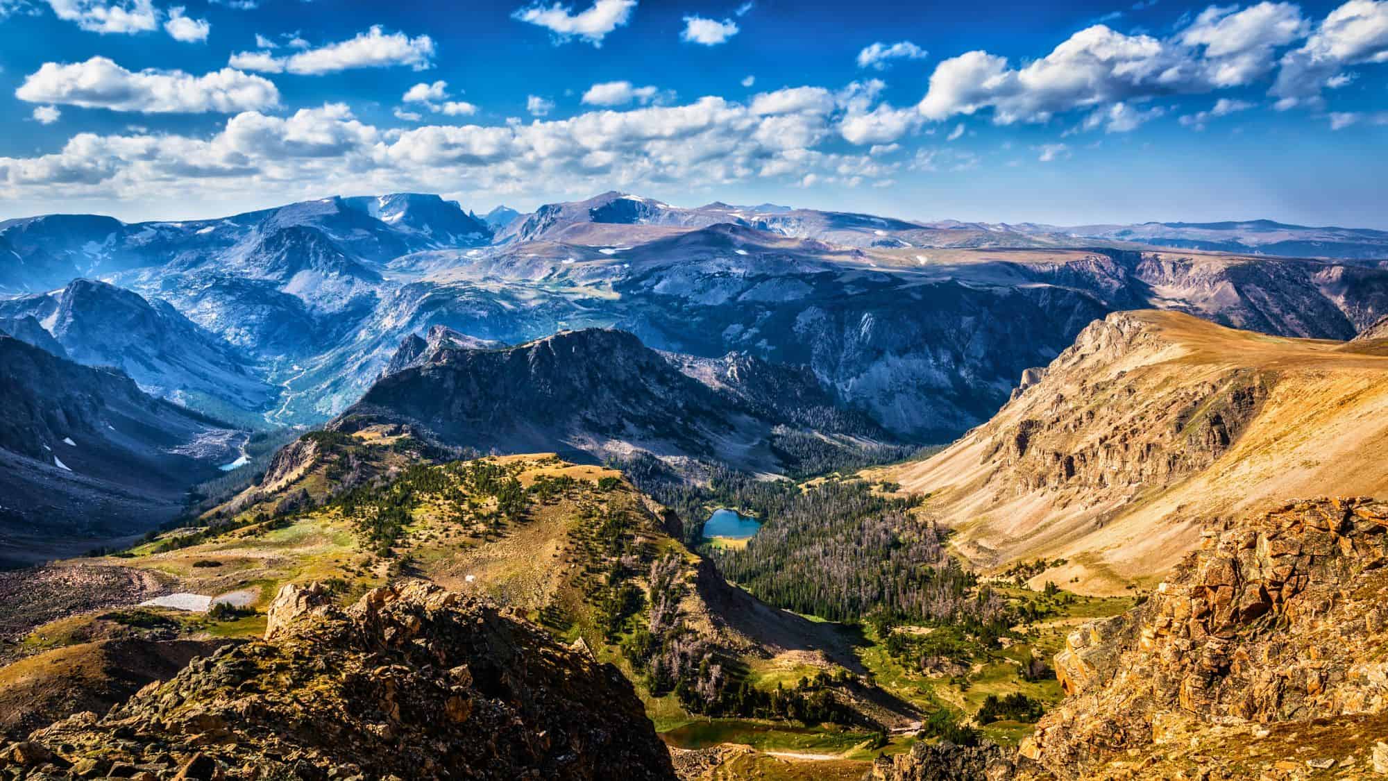
No superlative feels out of place for the Beartooth Highway, which climbs from the high plains outside Red Lodge, Montana, to the brink of the Beartooth Plateau (one of America’s wildest and least-touched regions).
The 68-mile highway packs one adrenaline punch after another: endless zigs and zags, sweeping switchbacks, and an ascent to nearly 11,000 feet. Opening typically from Memorial Day to mid-October, this high-elevation road is hemmed in by snowdrifts well into summer (sometimes higher than your vehicle).
Each overlook reveals stark, “top-of-the-world” landscapes, from lakes still rimmed with stray ice to wind-worn boulders and vast alpine tundra dotted with tiny wildflowers. Mountain goats nimbly pick their way across impossible slopes, unconcerned by the thin air and steady wind. The views, especially on clear mornings, span dozens of miles and include distant peaks jutting into pure blue sky.
With no services for most of its length, preparation is key: bring water, check road conditions, and fill up your tank in Red Lodge or Cooke City.
At the highway’s southern end, the route deposits you at the less-crowded northeast entrance of Yellowstone National Park, letting you dive into geyser country without the usual rush.
For those wanting a challenge, numerous trailheads climb away into the backcountry, offering the promise of true solitude above the tree line.
North Cascades Highway – Washington
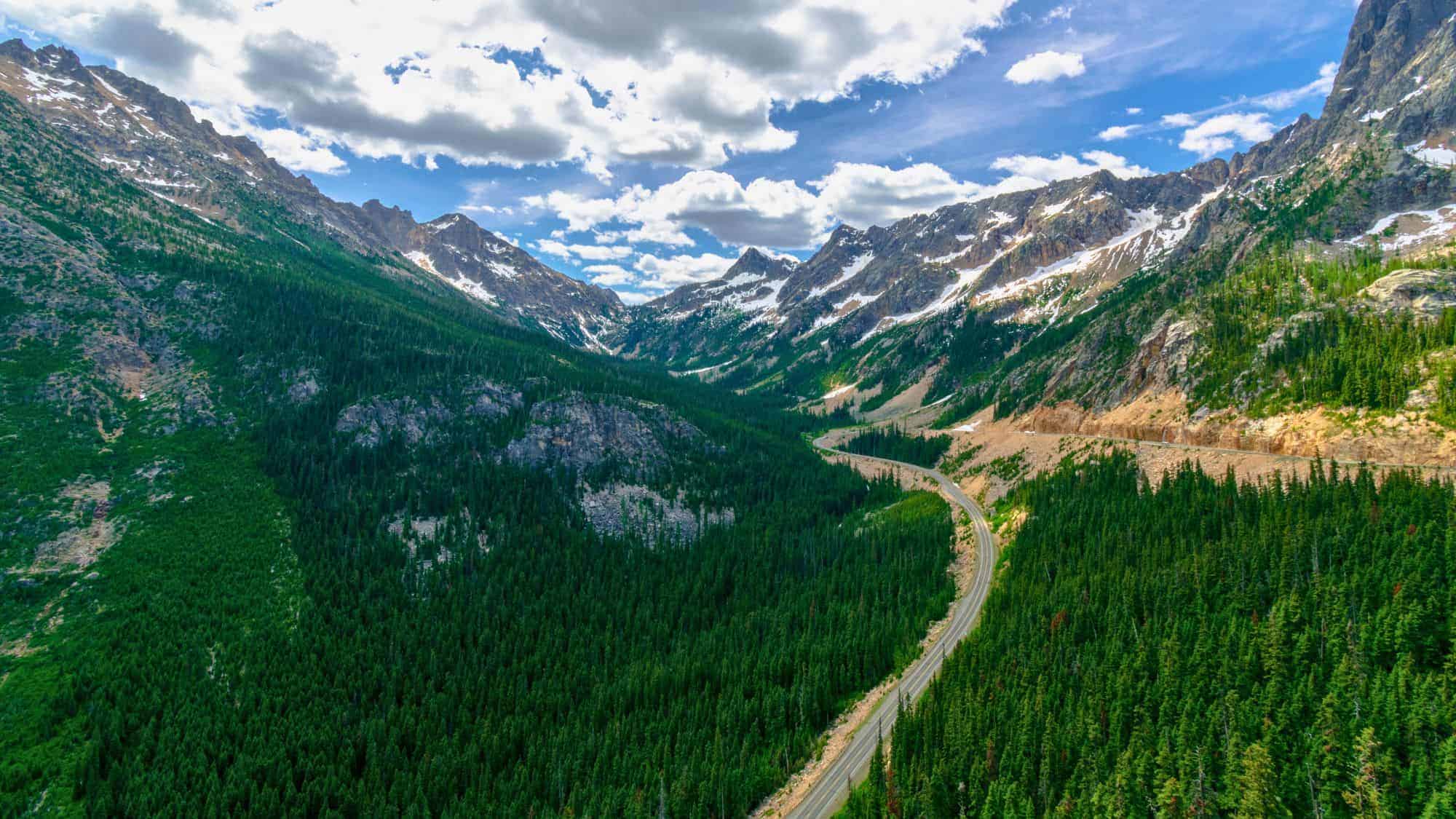
Cutting a swath through Northern Washington’s most rugged terrain, the North Cascades Highway, or State Route 20, dares you to lose track of time. This 140-mile route slices through the North Cascades National Park and its wild “American Alps”, a nickname earned by glacier-flecked summits and plunging valleys at every bend.
The drive demands patience in spring and early summer, as crews work to clear epic snowfalls that leave drifts up to 15 feet deep in places. When open, the road climbs sharply to Washington Pass, where a paved viewpoint offers sweeping vistas of Liberty Bell Mountain and the rumpled spine of the Cascades rolling away in every direction.
Diablo Lake, famed for its unreal turquoise water, anchors the drive midway, with scenic trails and picnic spots hugging the harsh bluffs above. Hikers and climbers scattered along the roadside vanish into trails crossing avalanche meadows, old-growth forests, and cloud-chasing ridgelines.
Each overlook has its own microclimate: some mornings are mist-shrouded and cold, while others explode with wildflowers and soaring hawks. And the towns of Winthrop and Marblemount, on opposite ends, exude unfussy mountain-town hospitality, with cozy lodges and gear shops.
Kancamagus Highway – New Hampshire
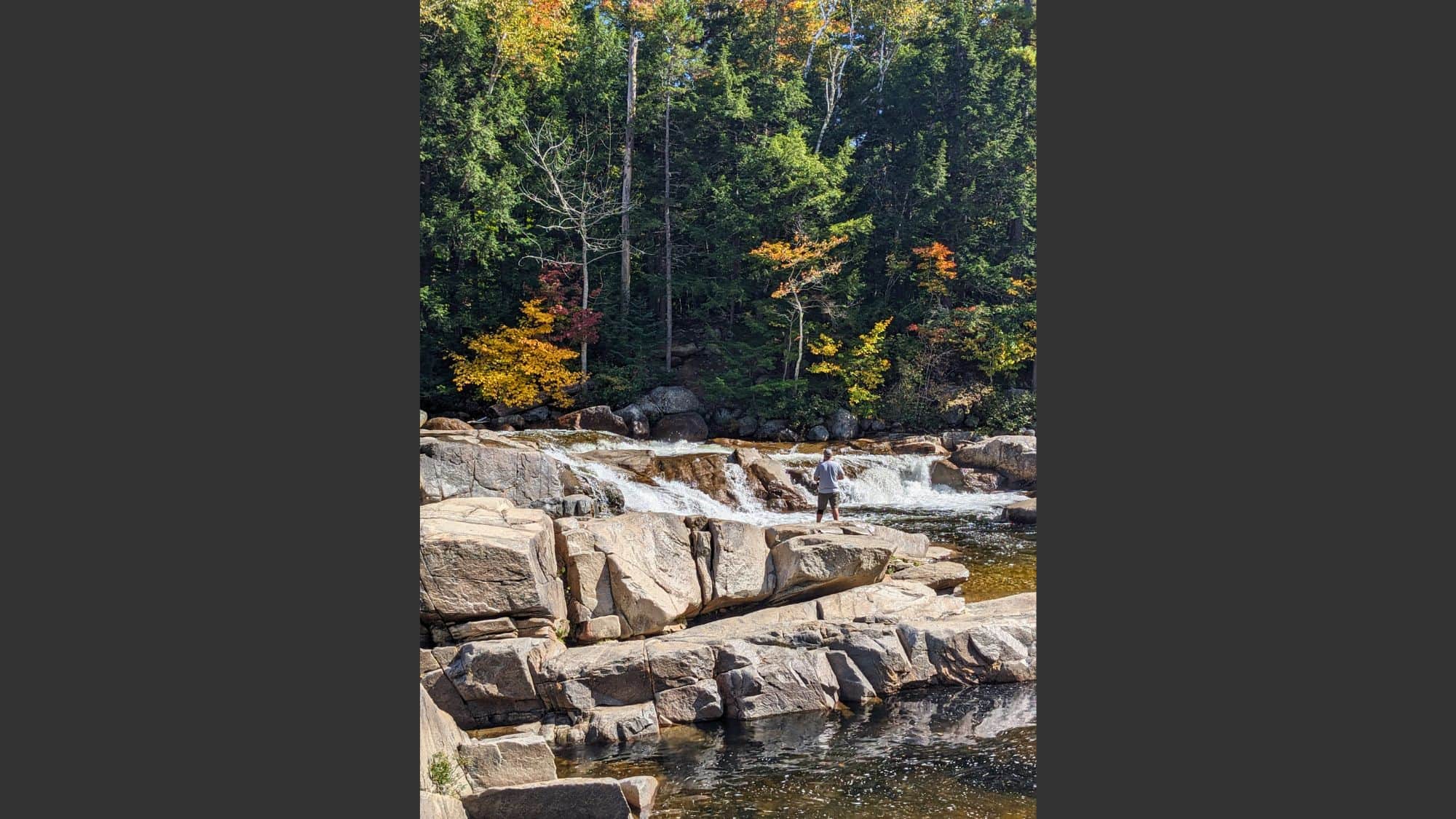
Threading through the White Mountains in New Hampshire, the Kancamagus Highway (AKA “the Kanc”) stands as living proof that shorter drives can dazzle just as much as longer ones. The 34.5-mile route is a symphony of forest, river, and granite, whisking you away from the bustle into untamed wilderness.
Aside from well-marked trailheads and roadside rest areas, there’s almost no commercial development (no gas stations, no billboards, no chain motels) just pure, raw scenery.
Sabbaday Falls, with tiered cascades cutting through mossy boulders, and the Albany Covered Bridge, an 1858 relic, are highlights for those seeking short walks or old-time craftsmanship.
Come fall, travelers descend from all directions to witness a landscape ignited with color, as red maples, birch, and beech trees set the mountainsides ablaze, often reaching peak spectacle in early October. In winter, the Kanc is often quiet, ribboned with cross-country ski tracks and the glinting paths of snowshoers. Each season brings its own pace, but the sense of timelessness and untouched character endures.
Be prepared for swift weather changes; fog settles with little warning and mountain storms can roll in. Still, the road’s elevation, frequent pulloffs, and sturdy construction mean even a rainy drive has its charms.
Needles Highway – South Dakota
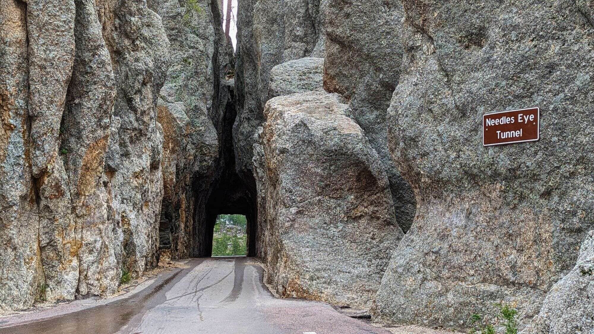
Passing through the Black Hills’ wild heart, Needles Highway is a testament to both engineering creativity and raw natural spectacle.
Stretching 14 miles, the road weaves and curls between towering granite spires, the “needles”, that spike the skyline, with jagged points and slender, wind-carved forms rarely found elsewhere.
Built in the 1920s as part of Custer State Park’s niche network, the road was intentionally made narrow, full of 180-degree turns and tunnels often only wide enough for small vehicles. The most famous is the Needle’s Eye Tunnel, a vertical slit through solid stone so improbably narrow that bigger pickups edge through inch by inch.
Wildlife surprises are frequent: bands of bighorn sheep and mountain goats can stop traffic, and wild turkeys sometimes feed beneath the pines. The drive itself is slow and purposeful, encouraging you to pull off, wander up short trails, photograph rock climbers scaling fortress-like walls, or simply soak in the cool scent of ponderosa pine on the breeze.
Custer State Park’s broader appeal is just steps away, so combine this drive with nearby Wildlife Loop Road for a full day among herds of bison and pronghorn, or hike to Sylvan Lake’s boulder-strewn shoreline.
Traffic is lightest at sunrise and sunset, illuminating the granite with golden light and casting deep shadows across the valleys.
Going-to-the-Sun Road – Montana

The Going-to-the-Sun Road is as close to a pilgrimage as American road trips get. This 50-mile marvel slices through the wild heart of Glacier National Park, climbing past rushing waterfalls, glacial lakes, and snow-laden peaks to crest the Continental Divide at 6,646 feet atop Logan Pass.
Every mile packs visual drama, from the curving ribbon of pavement clinging to vertical cliffs to the wildflower meadows and the iconic Weeping Wall, where runoff sheets across the road in early summer.
Since the route is fully open just a handful of weeks between late June and early fall (snow often lingers into July), timing is everything. Early birds beat both crowds and heat.
Tight size restrictions keep larger RVs and trailers off the most exciting sections, letting drivers focus on the sharp corners, vaulting vistas, and occasional mountain goat or bighorn sheep right by the shoulder.
The highlights are well known but always compelling: Hidden Lake Overlook, where mountain panoramas meet trails teeming with wildflowers and bears; Jackson Glacier overlook, with one of the park’s last visible rivers of ancient ice; and Lake McDonald’s pebble beaches, perfect for reflection (or a chilly dip).


