Discover Parks & Wildlife contains affiliate links and is a member of the Amazon Services LLC Associates Program. If you make a purchase using one of the Amazon links, we may receive compensation at no extra cost to you. We may also use select AI tools to support our creative process, but all content is reviewed, refined, and finalized by our human team. See our disclosure policy and our AI use policy for more information.
14 National Park Trails That Test Endurance, Nerve, and Common Sense
There’s a fine line between a refreshing vacation and a self-inflicted punishment, and it’s often drawn on a national park map. While some of us are content with a scenic drive and a lukewarm coffee, others seem drawn to a different kind of adventure.
The kind of hiking adventure that involves waking up before the sun, questionable life choices, and a serious reality check about one’s cardio fitness. These are the trails designed to remind us just how small and squishy we are compared to granite and gravity.
We’re not talking about a casual stroll where you might scuff your new sneakers. We’re talking about the heavy hitters, where preparation is the only thing standing between you and a very bad day. From sweltering canyons to the thin air of icy peaks, these paths lure you in with promises of glory and unparalleled beauty, only to make you earn every single inch.
It’s a special kind of fun that makes you question your sanity halfway through, only to find yourself planning a return trip the moment you get back to the car. Let’s take a look at some of the most notorious trails that will happily test your will to live.
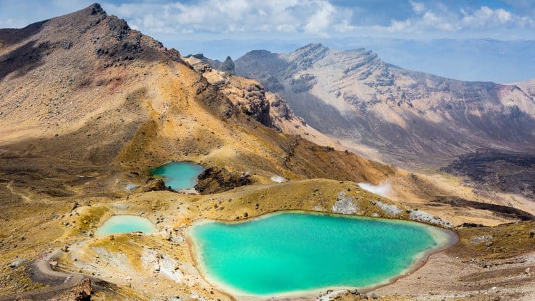
Rocky Mountain National Park, Colorado

If you are looking for a leisurely walk in the woods, this is definitely not it. The Keyhole Route on Longs Peak is less of a hike and more of a 13.6-mile-long “please-don’t-trip” situation. It’s technically classified as a scramble, which is just a polite way of saying you will be using your hands and feet to crawl over rocks while trying not to look down.
The park service warns that a fall here could be fatal, which is the kind of heartwarming advice you want to read before dawn. And you have to start this adventure well before sunrise, usually around 2 a.m., because afternoon thunderstorms are practically a scheduled event in the Rockies.
You really don’t want to be the tallest thing on the mountain when lightning starts doing its thing, just saying.
The route teases you with a manageable walk to Boulder Field, but the game completely changes once you pass through the Keyhole formation. You enter a world of narrow ledges and loose rock, where trail markers are painted bullseyes on stone.
You’ll navigate sections with names like “The Trough” and “The Narrows,” which sound just as claustrophobic and steep as they are. Reaching the summit of this 14,259-foot “Fourteener” is a brag-worthy bonus, but safely returning to the trailhead should be non-negotiable.
Grand Canyon National Park, Arizona

There’s a saying at the Grand Canyon: going down is optional, but coming up is mandatory.
Bright Angel Trail is the poster child for this piece of wisdom. It’s the most popular route into the canyon (probably because it starts conveniently near the village and looks deceptively easy), even though it is a whopping 16.4 miles.
You begin your day skipping down the path, gravity on your side, feeling like an Olympic athlete. But every step you take down is a step you have to haul yourself back up later, usually when it’s significantly hotter and your legs have turned to jelly.
The trail drops over 3,000 feet just to reach Havasupai Gardens, a shady oasis, and the hike out typically takes twice as long as the hike in. All the while, the heat inside the canyon can soar above 100°F in the summer, turning the trail into a human-sized convection oven.
The park service practically begs people not to hike to the river and back in a single day, yet someone always tries it, thinking they know best.
Zion National Park, Utah

Angels Landing is renowned for its final half-mile, a knife-edge ridge where you pull yourself up using chains bolted into the sandstone. The drop-offs on either side are about 1,000 feet, which is plenty of room to contemplate your life choices.
This is not the place for anyone with a fear of heights or a tendency to get dizzy. And this 4.7-mile trail has become so famous that it now requires a permit just to set foot on the scariest part. The permit system, managed through an online lottery, has helped reduce the crowds, but it also adds a layer of stress to your planning since you can’t just show up and climb anymore.
The hike starts innocently with a series of switchbacks, including the famous Walter’s Wiggles, which are steep but paved. Then you reach Scout Lookout, where the faint of heart usually stop to eat a snack and watch the brave (or foolish) continue onto the spine.
If you get a permit, you will need shoes with excellent grip and a lot of patience. And attempting this when it’s icy, snowy, or windy is a terrible idea; the park service makes it clear that your safety is your own responsibility.
The view from the top is spectacular, but you’ll probably be staring at your feet the whole way.
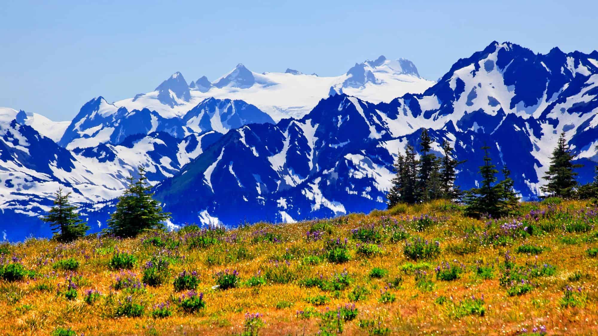
Mount Rainier National Park, Washington

While thousands of people attempt to summit Mount Rainier every year, most stick to the standard routes. Liberty Ridge is for those who look at a standard route and think it seems a bit boring.
This is a serious, technical climb, not a hike, and it’s considered one of the classic alpine climbs in North America. You’ll need ice axes, crampons, ropes, and the knowledge to use them without getting tangled.
The route ascends the mountain’s north face, which is steeper, colder, and more remote than the popular southern approaches. And you will be navigating complex glaciers and steep ice slopes, often with significant rockfall hazards.
The commitment level is huge because once you are on the ridge, retreating is difficult and dangerous. And storms can roll in from the Pacific with little warning, trapping climbers in whiteout conditions.
This route requires a climbing permit and a level of self-sufficiency that most casual park visitors don’t have. It is quiet, stark, and terrifyingly beautiful, offering a sense of isolation you won’t find on the main routes. This is the kind of place where you have to trust your climbing partner with your life, because a mistake has very few safety nets.
Denali National Park, Alaska

Denali is the highest peak in North America, and the 35.3-mile West Buttress Trail is the most popular way to the top. But “popular” makes it sound like a line at an amusement park, when it’s really a weeks-long expedition in one of the planet’s harshest environments.
While it’s considered the least technical route on the 20,310-foot mountain, that’s a relative term. You’re still dealing with massive crevasses, extreme cold that can freeze skin in seconds, and an altitude that makes just putting on your boots feel like a marathon.
Most climbers take about three weeks to get up and down, dragging heavy sleds of gear behind them like stubborn pets. And the park service strongly advises against solo travel because if you fall into a crevasse alone, you’re likely staying there.
You must also be proficient in glacier travel and crevasse rescue. There are fixed lines installed by rangers on steeper sections to help you haul yourself up, but you still need to know what you’re doing.
The weather on Denali is the boss; it can shut down climb attempts for days, forcing you to play cards in your tent while the wind screams outside. Success isn’t guaranteed, and rescue depends on the weather, so you have to be ready to take care of yourself.
Glacier National Park, Montana

If you want big sky views without having to summit a peak, Highline Trail is a top choice, as long as you don’t mind walking on a shelf cut into a cliff.
The trail follows the Continental Divide and is famous for a section called the Garden Wall. For a stretch, you walk on a ledge only a few feet wide, with a sheer drop on one side and a rock wall on the other. There is a hand cable bolted into the wall for part of it, which offers a nice psychological comfort blanket (even if the path is wide enough for walking).
It’s a really long day, around 15.1 miles if you hike from Logan Pass Visitors Center, where most people catch a shuttle. But the views are relentless, just miles of jagged peaks and glacial valleys that look like a painting.
You’ll even likely see mountain goats and bighorn sheep navigating the cliffs with an annoying amount of ease while you cling to the cable.
Despite the terrifying drop-offs, the trail is relatively flat compared to a summit climb, which makes it popular. However, getting caught here in a thunderstorm or high winds is a nightmare scenario, so checking the forecast is critical.
Haleakala National Park, Hawaii

Walking into a dormant volcano sounds like a great science fiction plot, but at Haleakala, it’s just a Tuesday. The Sliding Sands Trail, or Keoneheʻeheʻe, begins near the summit visitor center, which sits at about 10,000 feet.
The landscape looks like Mars: red and black cinder cones, zero vegetation, and a silence that is almost deafening.
The trick with this 18.2-mile trail is that you start by hiking down. It feels easy. You cruise along, gravity is your friend, and the views are otherworldly. You descend about 2,800 feet to the valley floor, and that’s where the trap snaps shut.
The hike back out is brutal. You are already at high altitude, so there is less oxygen for your muscles, and now you have to climb all that elevation you just lost. The loose cinders slide under your feet, hence the name, making it feel like for every two steps you take up, you slide one step back. And the sun is intense because there is absolutely no shade.
It’s a stunning place to realize you may have made a terrible mistake regarding your cardio preparation. Many hikers wisely choose to go only part of the way down.
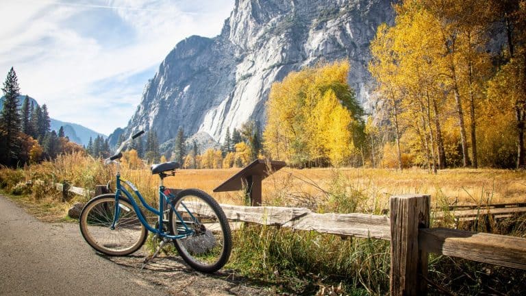
Yosemite National Park, California

This is arguably one of the most famous hikes in the world. The sheer granite face of Half Dome dominates the valley, and climbing it is a rite of passage for many.
Permits are required seven days a week when the cables are up, and they are distributed via a lottery that is notoriously hard to win. The hike is also a beast, clocking in around 17 miles round trip with 5,300 feet of elevation gain. But the main event is the cables.
For the last 400 vertical feet, you pull yourself up the slick granite dome using two steel cables as handrails. It is steep, exposed, and often crowded. And you might find yourself stuck in a line of people, staring at the heels of the person in front of you (praying they don’t let go).
The park service is very clear: do not go up if storm clouds are present. The rock becomes an ice rink when wet, and lightning strikes are a serious threat on the exposed summit.
And don’t forget your sticky rubber shoes and sturdy gloves to protect your hands from the steel cables. It’s a long day, but the bragging rights are forever.
Sequoia National Park, California

Standing at 14,505 feet, Mount Whitney is the highest point in the lower 48 states, making it an absolute magnet for hikers who love superlatives and thin air.
While the summit technically sits on the boundary of Sequoia National Park, you actually start this beast of a hike in Inyo National Forest at Whitney Portal, about 13 miles west of Lone Pine. The standard trail is a 22-mile round-trip slog that gains over 6,600 feet in elevation, which is just enough to make you question every decision that led you to this moment.
It is a long, lung-busting day that requires an alpine start (think midnight or 1 a.m.) if you want to be down before dark. And you need a permit to hike here, whether you are day-hiking or camping, and the lottery is highly competitive.
The trail is non-technical in the summer, meaning you don’t need ropes, but it is relentless. The famous “99 Switchbacks” section is exactly what it sounds like, a repetitive grind that tests your mental fortitude as much as your quadriceps.
One unique feature of this hike is the waste disposal requirement. You are given a “WAG bag” when you pick up your permit because you have to pack out your own solid human waste. There’s no digging catholes in the rocky alpine soil.
Carrying your own poop down the mountain really adds a special flavor to the experience (mostly psychological, hopefully). And if that wasn’t enough, altitude sickness is very common as well.
Great Smoky Mountains National Park, Tennessee & North Carolina

Don’t let the funny name fool you; this section of the Appalachian Trail offers some of the most dramatic scenery in the Smokies. The “Bunion” is a stone outcropping that juts out from the ridge, providing massive panoramic views of the mountains.
To get there, you hike about 4 miles out from Newfound Gap, making it an 8-mile round trip. While it isn’t at the high altitudes of the Rockies, the trail is rugged, rocky, and steep in places. You walk along the spine of the mountains, traversing narrow ridges that drop off steeply into the forested valleys below.
The exposed rock face was created by a huge fire in 1925, followed by a flood that washed away the soil, leaving a bare knob that looks incredibly out of place among the lush greenery. And the drop-offs at the Bunion itself are significant, so it is not the best place for a picnic if you are clumsy.
The weather here can change in an instant, with fog rolling in to obscure the views in minutes. It is a heavily trafficked trail, so you won’t be alone, but the constant ups and downs will definitely make you sweat.
Bryce Canyon National Park, Utah
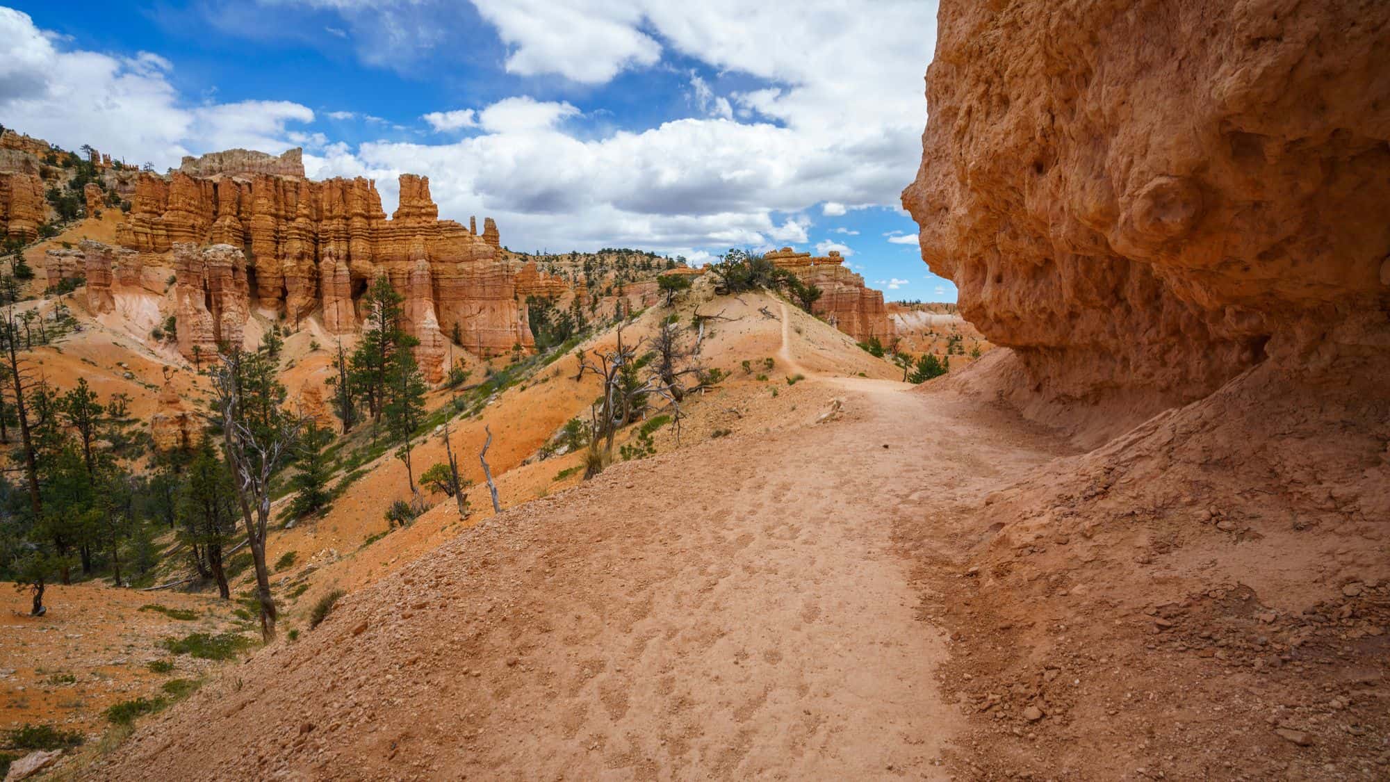
Bryce Canyon is famous for its hoodoos (those weird, spire-like rock formations that look like drippy sandcastles). And the Fairyland Loop gives you a front-row seat to thousands of them, but it makes you work for it.
At 8 miles long with about 1,500 feet of elevation change, it’s considered strenuous because you are constantly going up and down through the amphitheater canyons.
Unlike the main viewing areas, this trail is less crowded because the park shuttle doesn’t stop at the trailhead. You have to really want to be here. But the scenery is surreal, with pink, orange, and white rocks surrounding you on all sides. It can feel like walking through a Dr. Seuss book.
Since Bryce is at a high altitude, reaching up to 9,115 feet, the air is thinner than you might expect, making even basic climbs feel harder. And you are fully exposed to the sun for large sections of this hike, so hydration is critical.
In the winter, the trail can be buried in deep snow, requiring snowshoes, but in the summer, it’s a dusty, beautiful grind.
Acadia National Park, Maine

If you prefer climbing ladders to walking on dirt, Precipice Trail is your spot. Located on the east face of Champlain Mountain, this 2.7-mile trail is basically an obstacle course of iron rungs, ladders, and handrails drilled directly into granite cliffs.
It is short, steep, and completely non-technical in terms of gear, but mental steel is required. You pull yourself up vertical rock faces with nothing but air beneath your boots. And it’s often compared to a “via ferrata” route, so it is absolutely not for small children or anyone who gets weak in the knees at heights.
One of the quirks of this trail is its seasonal closure. It’s often closed from spring until mid-August because peregrine falcons nest on the cliffs. The park takes protecting the chicks very seriously, so you have to time your visit for late summer or fall.
Going up is the only real option; trying to climb down the ladders against the flow of traffic is dangerous and rude. Once at the top, you hike down a much gentler path (thankfully).
It’s a thrill ride that offers incredible views of the Atlantic Ocean, provided you’re brave enough to look away from your hands for even a second.
Yellowstone National Park, Wyoming

Yellowstone is famous for geysers and bison-induced traffic jams, but Specimen Ridge offers a different kind of wild. This strenuous, 17.7-mile trail takes you up a ridge to see ancient petrified trees, some still standing upright after 50 million years.
The trail isn’t always well-defined, often following game trails or just the path of least resistance up steep slopes. And you are exposed to the elements the entire time, which in Wyoming means wind, sudden hail, or scorching sun.
But the real kicker here is the wildlife. You are hiking in prime grizzly bear habitat. The park warns that grizzlies frequent the area, which adds a certain spice to every rustle you hear in the bushes. So you need to hike in groups, make plenty of noise (singing bad 80s pop songs helps), and carry bear spray on your belt, not buried in your pack.
If you are brave enough, it offers an untamed experience where you are definitely not at the top of the food chain. Just remember that lightning is also a major risk on the open ridge, so you have to keep one eye on the sky and one looking for bears.
Olympic National Park, Washington
This is not a day hike; it is a 42-mile odyssey. Reaching the 7,980-foot summit of Mount Olympus involves a long approach through the Hoh Rain Forest, which is lush, wet, and incredibly muddy.
You hike roughly 17.5 miles just to get to the base of the climb at Glacier Meadows. From there, you enter a world of ice and rock. You have to cross the Blue Glacier, which requires technical mountaineering skills, rope teams, and crevasse rescue knowledge. It’s a complex mix of backpacking and mountaineering that filters out anyone who isn’t fully committed.
The summit block itself is a rock scramble that sits atop the icy throne of the mountain. Because it is so remote and hidden in the center of the park, very few people actually see the mountain, let alone climb it.
The weather is notoriously fickle, as the peak catches moisture coming off the Pacific Ocean, meaning you can get soaked, frozen, and sunburned all in the same day.
It’s a true wilderness experience where help is a long, long way away. But if you make it, standing on top feels like you are on the edge of the world, surrounded by a sea of peaks and glaciers that few eyes ever see up close.
Like Our Content? Follow Us on MSN (or click the Follow Button above) for more from Discover Parks & Wildlife.